| Today, the major pieces
of Charlotte's highway network include the Outerbelt (I-485), Interstates
77 and 85, and the Brookshire and Belk Freeways (I-277), but nearly sixty
years ago Charlotte's first major urban highway project would begin.
The construction of Independence Boulevard in the 1940s and early 1950s
would give Charlotte and North Carolina its first urban expressway, and
would usher in a new era of highway building throughout the state.
With the help of former mayor, Ben Douglas - who sat on the State Highway Commission in the 1940s - the push for building Independence Blvd. began. In 1946, city residents passed a $200,000 bond issue that would go along with over $2 million in federal funding. The highway would open in two stages in 1949 and 1950. When a grade separated interchange was built at South Blvd. and Morehead St. in the mid 1950s, Independence Blvd. was completed. (1) Although the highway was not a fully controlled access highway, it gave motorists an express routing on the southern edges of the city.
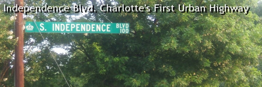
Changes to Independence Blvd. would begin in the 1980s. The construction of the Belk Freeway (I-277) would have the most dramatic impact. Later, the conversion of East Independence Blvd. to a freeway made additional changes to the highway. The most recent change was the completion of extending the freeway to Albemarle Road in 2006. Other changes like lengthened surface streets and the growth of the uptown area have impacted the original route. Over the years, parts of Independence Blvd. have been renamed to Carson Blvd. and Stonewall St. In June 2007, South Independence Boulevard was renamed Charlottetowne Avenue. The decision, initiated by the Charlotte Department of Transportation, was made because of confusion between the nearby Independence Freeway and the surface street. As a result, Independence Blvd. now only exists on US 74 as you head east of the city. (2) Here, we'll look at photos of the then newly opened Independence Blvd. in the 1950s - courtesy of the Robinson-Spangler Carolina Room – Public Library of Charlotte and Mecklenburg County, take a look at Independence Blvd. from the air (in 1965), and finally see what's left of Independence Blvd. today. You'll be surprised at what you can still find! Any questions or comments
about Independence Blvd. can be directed to the webmaster.
Independence Blvd. in the 1950s - Take a trip back to the early years of Independence Blvd., courtesy of the Robinson-Spangler Carolina Room – Public Library of Charlotte and Mecklenburg County. Independence by Air - Aerial shots of Independence Blvd. and Charlotte in 1965 from Aerial Photographs of Mecklenburg County, N. C. from National Aerial Surveys, Photogrammetric Engineering in Charlotte. Old Independence Today - Chris Curley takes you along a tour of what's left of Independence Blvd. in South Charlotte today. Site Navigation:
Page Created: October 12, 2006
© 2006 William Lawson |
