 |
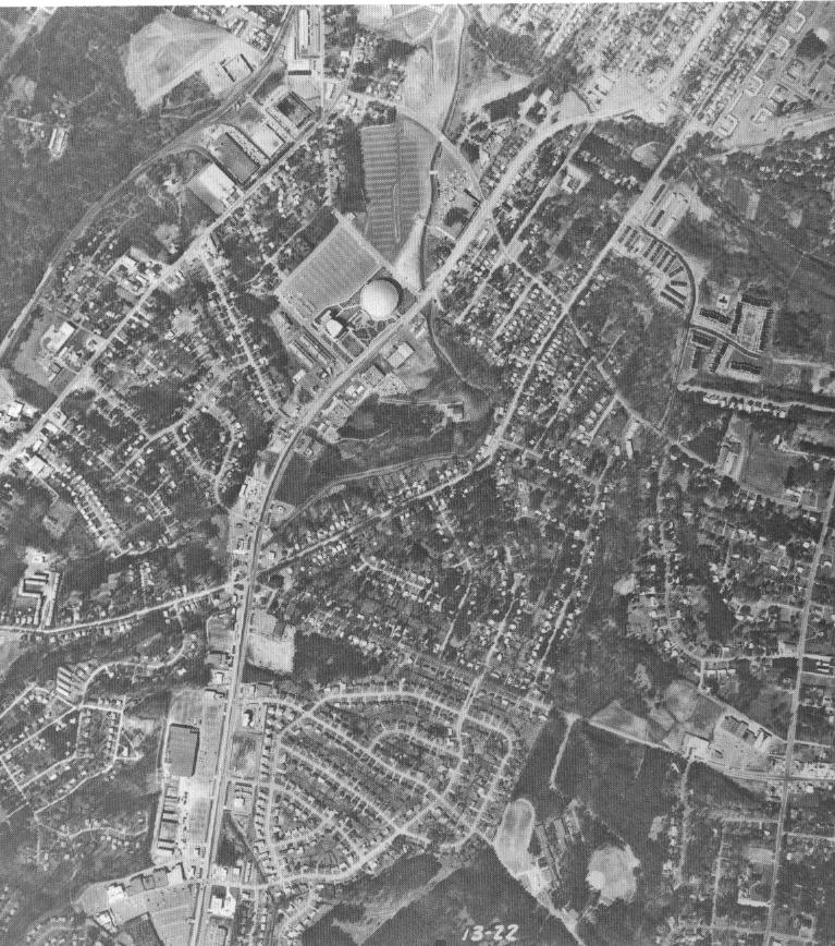
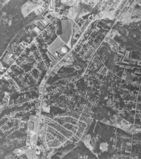
Independence Blvd. near the then Charlotte
Coliseum and Eastway Drive. Independence Blvd. runs top (west) to bottom
(east) in the center of this photo. The Charlotte Coliseum
- now Cricket Arena - is in the top center of the photo. Many changes
have taken place since this photo was taken. In the photo, you can
see a street that parallels and then crosses Independence which is Commonwealth
Ave. There is a street that also ends at that intersection that goes
off to the right. That is Eastway Drive. Commonwealth Ave.
was split up when Eastway was extended across (and over) Independence,
as a result of the Independence Freeway construction of the early 1990's. |
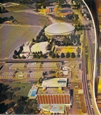 |
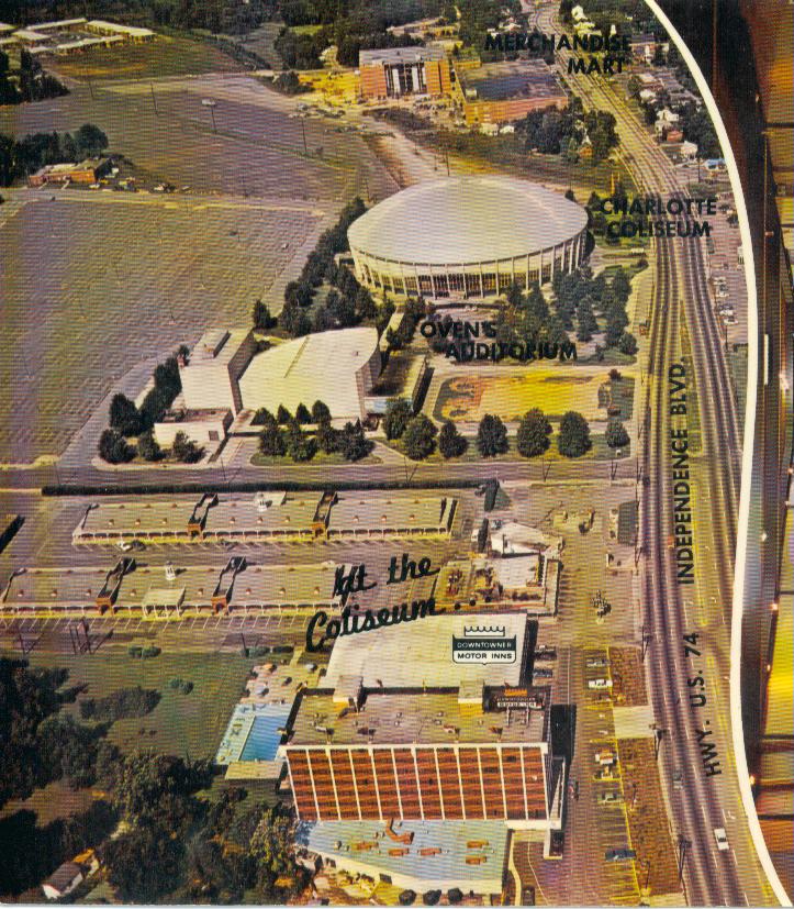
1960's Postcard Image of Independence Blvd.
@ Coliseum, Ovens Auditorium, and Merchandise Mart. Much of the roadway
has changed since this aerial image was taken. Independence is now
divided by a median. The turning lanes are gone, a partial interchange
has been built giving westbound traffic access to the Arena parking lots.
Postcard courtesy of Chris Curley. |
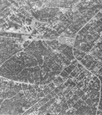 |
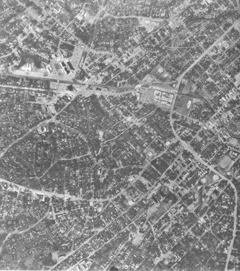
Independence Blvd. near the Midtown Square
Mall. Independence starts at the lower right and snakes its way past
the mall , which will be town down in 2002, before exiting in the upper
left. Here you can see Independence follows its current route past
Memorial Stadium to the old Charlottetown Mall (now Midtown Square) and
then up what is now Stonewall St. |
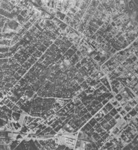 |
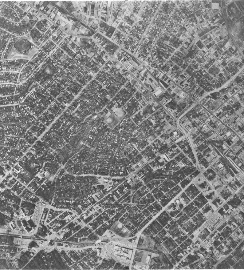
Independence in the vicinity of South Blvd.
Here, Independence starts in the lower center and zigzags with the help
of various ramps to exit in the upper left hand corner. You can see
where it curves left onto what is now South Blvd. It went under Morehead
St. and then made a sharp right onto what is now Carson Blvd. The
ramps before the curve are for South Blvd. The baseball diamond in
the center of the picture is old Crockett Park where the Charlotte O's
played. The park burned to the ground in 1985, and they moved to
Fort Mill. The neighborhood along Independence past the mall was demolished
in the late 60's. There are still stairs off the sidewalk that go
nowhere along this stretch of old Independence near the William's Mark. |