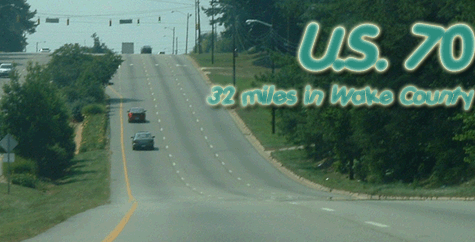
Route:
|
Enters Wake County 3 miles northwest of RDU Int'l Airport.
Leaves Wake County 6 miles southeast of Garner.
Runs basically northwest-southeast through the county.
|
Major
Intersections:
|
I-540 exit 4A-B, at the airport (exit 293 from 70).
M-NC 50 from Crabtree Valley Mall to Garner.
I-440 exit 7A-B, just past Crabtree Valley Mall.
M-US 401 through downtown Raleigh.
I-40/440/US 64 exit 298A-B, south of downtown.
I-40 (again), exit 306A-B.
|
History:
|
US 70, the precursor to I-85 between Durham and Greensboro, originally came into Raleigh via today's NC 54. It was co-signed with the original NC 10, which ran across the state until about 1933. The routing was Chapel Hill Rd through Cary, Hillsborough St and Wilmington St through Raleigh, then Garner Rd through (surprise!) Garner and points southeast. By 1940 what is today Glenwood Ave was finished and US 70 was moved onto it. The routing in the northern half of the county hasn't changed since then.
Or has it? The hand-drawn maps of the 1940s aren't exactly testaments to GPS-enhanced technology, and since Glenwood and Leesville Rd (formerly NC 9, later US 70A) are relatively close to each other -- especially given that when you're talking in terms of maps the size of the entire state -- US 70 may have stayed on Leesville for a while in the '40s. From what I gather, Glenwood was finished by 1940 (otherwise, why change the numbers, other than to confuse people?), but it could have been as late as '42 or '43. If anyone knows for sure, feel free to share.
The "bypass" through Garner was built in the late '40s or early '50s. It isn't much of a bypass anymore, considering all the development along it, but it is outside of the "official" downtown area. The road that used to carry 70, appropriately called Garner Rd, has been SR 1007 since 70 was moved onto the bypass.
70 has been 4 lanes or more through Wake County since Glenwood Ave was built in 1940. For about 5 years, 70 and NC 50, which shares a lot of pavement with 70, were multiplexed on the Beltline, but they returned to their former routes through downtown (albeit with a no thru trucks restriction) in 1995.
|
Attractions:
|
For a road in a relatively flat part of the state, 70 (especially the Glenwood Ave. portion) is very hilly through Raleigh. Near the airport, a hilly stretch of 70 is the only portion of road signed at under 55 mph between Durham and Millbrook Rd; lots of businesses on either side of the road (with very poor visibility) add to the fun of driving along. 70 is actually above the grade of I-540 at this point, but quickly drops down to occupy the lowest level of the three at the I-540 interchange. (Want a good roller-coaster ride? Take 70 west from Raleigh, exit onto 540 -- about a 50-foot drop here -- then get onto 540 west on a ramp that goes back up 40 feet or so.)
If you're looking for something to do in Raleigh late at night -- heaven help you -- you could do worse than driving down to the south end of Glenwood Ave., past where 70 and 50 jump onto Wade Ave. Lots of nightclubs and restaurants occupy the southernmost ten blocks or so of Glenwood. (Yes, this is what passes for nightlife in Raleigh. Don't shoot me, I'm only the messenger.)
The three tall towers along 70 east of Garner hold antennas for the three major local television stations, as well as a host of radio stations. The centermost tower, for WRAL-TV and a couple other radio stations, is 1,999' high and is a replacement for a tower that fell during a 1989 ice storm. |
Comments:
|
70 covers just about every sort of territory imaginable in Wake County -- from shopping malls to parkway-like stretches to large old houses (not to mention the old oak trees) to a typical eastern North Carolina landscape east of Garner. Now that I-540 has been completed, 70 has essentially been replaced as the main route from North Raleigh to points west, and to that end 70 is the only road in the county (especially inside 540) that has seen a net decrease in traffic over the past ten years. That said, the area around Crabtree Valley Mall and the Beltline is still a traffic nightmare, especially during peak shopping seasons.
Many maps from the late '70s and early '80s imply that there was a partial interchange between Glenwood and Creedmoor Rd, at the northwest corner of Crabtree Valley Mall. I had my doubts about this, and received an email1 verifying that this never existed. If you have a copy of a map from that time frame (the one I remember was a Champion '83 or '84) that shows this, drop me an email and I'll try to put it up here. (My copy has long since disappeared.) |