Pictures:
|
|
Route:
|
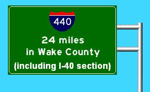
I-440 (the Beltline) is a loop around Raleigh. Its exit numbers start at 1A/B, at the I-40/US 1/US 64 interchange, and go up to 16, at I-40 in SE Raleigh. I-40's exits supercede 440 in the multiplexed section.
|
Major
Intersections:
|
M-I-40 from I-40 exit 293 to exit 301.
M-US 1 from exit 1 to exit 11.
Eastern terminus of NC 54 at exit 3.
US 70/NC 50 at exit 7.
US 1/US 401 at exit 11.
US 64/US 264 at exit 13.
|
History:
|
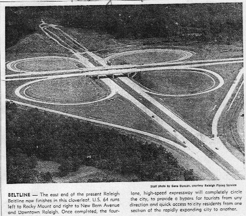
As is the case with I-240 around Asheville, I-440 was built in bits and pieces, and it was a freeway long before it was an interstate. The first sections to open went from the US 1/64 interchange southwest of Cary to North (today's Capital) Blvd. in 1962 or so--see the US 1 page for more info on this. The next section was from North Blvd. to New Bern Ave., following the previous sections by about a year. And this was the Beltline until the early '80s. However, the southern reaches of the Beltline were in the eternal "planning stages" (meaning the DOT couldn't get the right of way fast enough) for another 20 years after the completion of the northern half of the freeway.
And, now for a bit of I-40 history. Today's Wade Ave. freeway past the new arena and Carter-Finley stadium was originally I-40. I-40 around the southern reaches of Raleigh proper did not exist until 1983 or 1984. This included the section of the Beltline from what is today Exit 1 to Exit 13 (New Bern Ave.). At this point, there was a complete beltline around Raleigh, and it was signed as plenty of various roads--US 1, 70, 401, NC 50, and I-40 were all on it somewhere.
This "multiplex hell" caused relatively few problems, since everyone simply referred to the road as "the Beltline." But, for out of towners, the road was quite confusing, and subsequently NCDOT signed I-440 over the entire loop in 1991. Slowly, the roads that had been put on the Beltline in the mid-'80s were returned to their original routes through downtown Raleigh, so that all that is signed on the Beltline today are I-40, I-440, US 1, and US 64.
Starting in 1991, I-440 was widened all the way around--the first part, from Glen Eden Dr. to Wake Forest Rd. opened in 1993. Today, the entire Beltline contains no fewer than six lanes, except from Wade Ave. to I-40/US 1/64. And this section is scheduled for widening within the next 10 years.
|
Attractions:
|
Goes very close to the State Fairgrounds at NC 54 and at Wade Ave. In previous years, people have parked on the side of 440 for the State Fair, a practice now discouraged by the Highway Patrol. Other than that, however, it doesn't go past much.
|
Comments:
|
The northern part of 440 (exits 1-16) is in pretty good shape, with the exception of the section between I-40 and Wade Ave. But this section is scheduled for upgrading, so I won't dwell on it.
I-440 is the only Interstate in the country that doesn't use cardinal directions to describe its course -- rather, "Inner" and "Outer" I-440 is the official NCDOT standard. However, signage of this is haphazard at best, and eventually NCDOT plans to remove I-440 from the I-40 multiplex and resign what is now the northern 16 miles as an east/west highway.
|