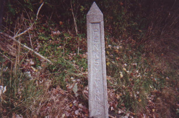
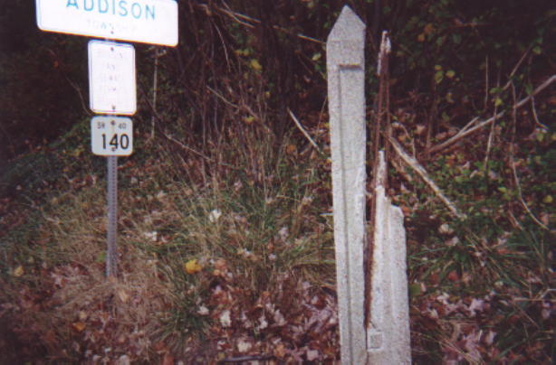
As you head east on this historic highway, you will come across prior alignments of the original National Road and of US Route 40. There is one such instance immediately after you enter Pennsylvania. It is easily accessible since it is signed as 'Old Route 40.' Another old alignment of the roadway is located in Addison. This alignment leads to history as the Petersburg Toll House still stands. The old alignment can easily be traced via the Pennsylvania Path of Progress signs.
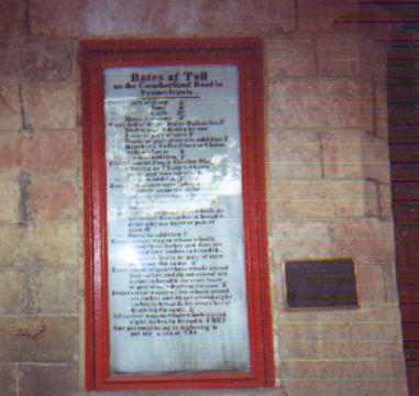
The toll schedule
at the Petersburg Toll House.
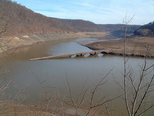
Traveling west from Addison, you will cross the Youghiogheny River. The river has been dammed and the result, Youghiogheny Lake, is a very popular recreational lake. However, there is a past to this lake. In 1942, the Yough was dammed as Yough Lake was formed. The National Pike used to cross the river at a much lower elevation. In fact, a town, Somerfield, once existed on the river's eastern shore. The bridge was a stone-arch bridge which were found widespread on the original pike from the pioneer days. The three arch span was the longest bridge constructed on the original road.
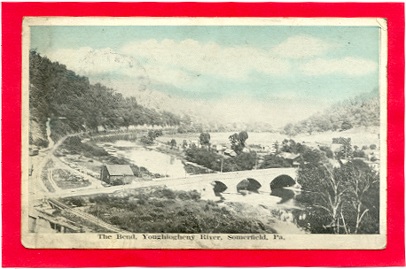
When the Yough was dammed, the river flooded Somerfield and the bridge. Traffic was already diverted onto a high-level bridge. This bridge, although narrow and often in need of repair, still carries traffic on US 40 today. However, many times when the water levels of the Yough Lake are extremely low, the old bridge and foundations of Somerfield can be seen. On Thanksgiving Day, 2001, Vince Ferrari photographed the original 'Big Crossings' bridge. It is amazingly intact. Currently, construction for a new Yough River Bridge is taking place. This bridge will replace the narrow 60 plus year old bridge and will be just north of the current crossing. The new bridge should be open sometime in 2006.
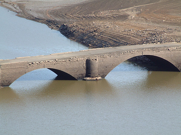
A close up of the
sandstone bridge shows how amazingly excellent shape it is in after being
underwater for over 50 years.
Page Created: April 1, 2002
Last Updated: October 31, 2004
(C) 2002-04 William Lawson