The Casselman River Bridges and Grantsville
|
The National Road:
Maryland
The Casselman River Bridges and Grantsville |
One of the "must
sees" along the National Road in Western Maryland is the Casselman River
Bridges just east of Grantsville.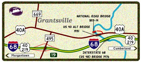 What makes this location unique is that within 1/4 of a mile sits three
bridges from three different eras of transportation. The area is
known as 'Little Crossings', named such by George Washington in 1755.
The three bridges that cross the river include: an 80 ft stone arch bridge
constructed in 1813, a truss bridge that currently carries US 40 Alt built
in 1931, and finally dual spans that carry Interstate 68 built in 1976.
(See map at right.)
What makes this location unique is that within 1/4 of a mile sits three
bridges from three different eras of transportation. The area is
known as 'Little Crossings', named such by George Washington in 1755.
The three bridges that cross the river include: an 80 ft stone arch bridge
constructed in 1813, a truss bridge that currently carries US 40 Alt built
in 1931, and finally dual spans that carry Interstate 68 built in 1976.
(See map at right.)
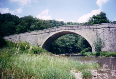
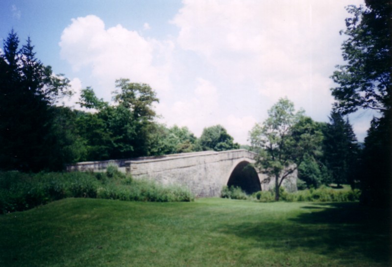
The stone arch bridge is a popular stop for photography and picnics. When it opened in 1813, the 80 foot span was the largest of its kind in the United States. The bridge would carry traffic for nearly 120 years when the steel truss bridge was opened within 500 feet to the south. After sitting without use for about 20 years, the bridge was restored in the mid-1950s and is now the focal point of Casselman River Bridge State Park. (1) There is plenty to do and enjoy nearby the bridges. On the eastern landing of the stone bridge is the Spruce Forest Artist Village. This village features the wares of local craftsmen and artists, numerous restored buildings, and the historic Stanton's Mill. Also part of the complex is the Penn Alps Craftshop and Restaurant. Finally, the town of Grantsville is a classic Western Maryland village. Grantsville has been in existence since 1785 and began as 'Cornucopia', the town is named for Daniel Grant who was given the land in 1785. Grantsville is a historic town with plenty of inns and recreation activities nearby. Below photos of the Casselman River Stone Arch Bridge: |
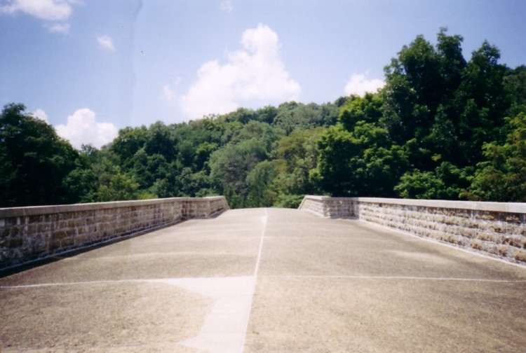
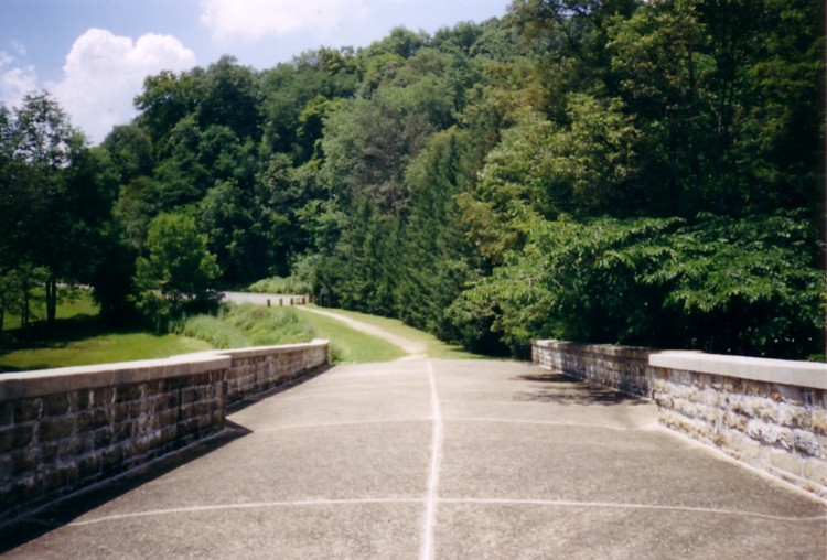 Looking
west and into Casselman River Bridge State Park. Looking
west and into Casselman River Bridge State Park. |
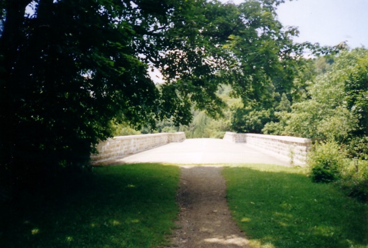 From
the eastern landing of the bridge. From
the eastern landing of the bridge. |
 The
bridge narrows at its Apex. The
bridge narrows at its Apex. |
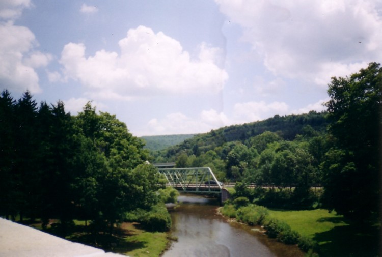 Looking
downstream to the 1931 US 40 Alt bridge. Looking
downstream to the 1931 US 40 Alt bridge. |
 An
upstream view of the bridge. An
upstream view of the bridge. |
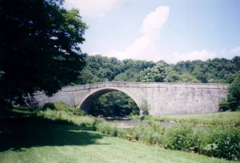 Wide
shot of the bridge in Summer. Wide
shot of the bridge in Summer. |
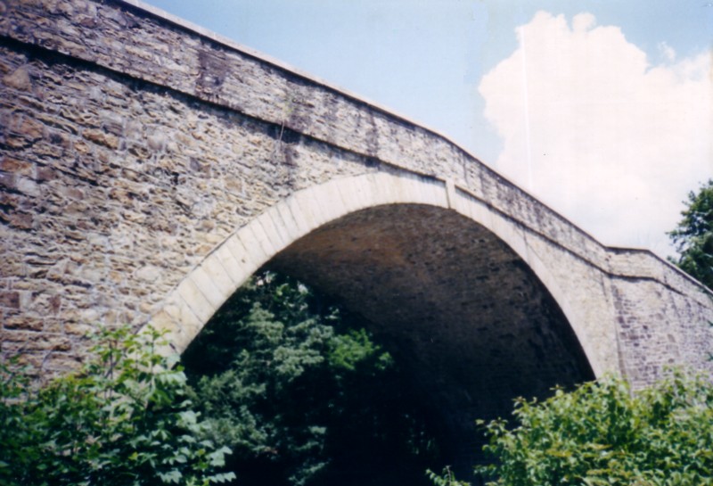 A
closer view of the archway. A
closer view of the archway. |
 One
last look at the stone arch bridge. One
last look at the stone arch bridge. |
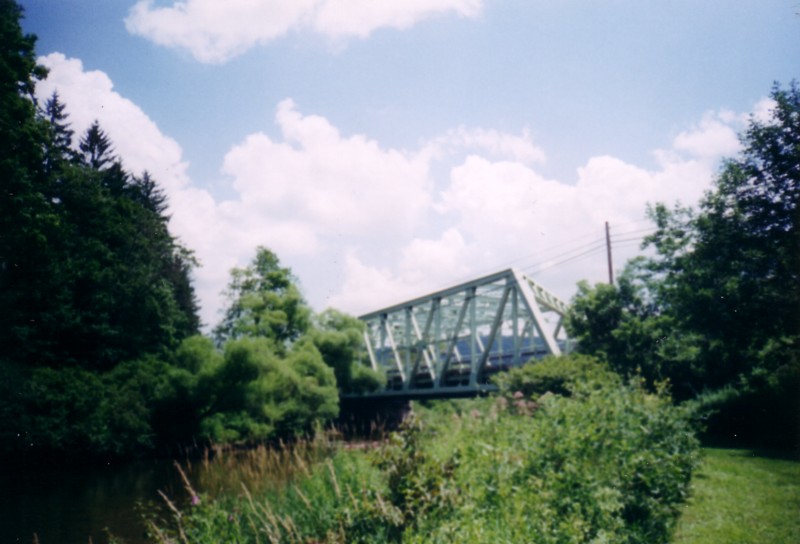 The
1931 bridge surrounded by trees. The
1931 bridge surrounded by trees. |
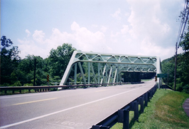 Looking
westbound towards the 1931 bridge. Looking
westbound towards the 1931 bridge. |
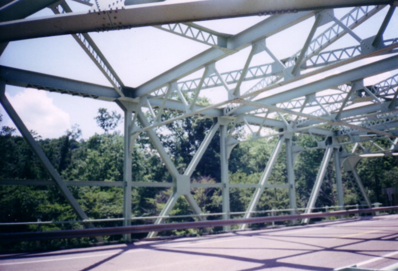 Some
of the interior truss work. Some
of the interior truss work. |
Continuing on the Trail:Sources & Links:
Page Created: October 31, 2004
(C) 2004-06 William Lawson |