
| The Route:
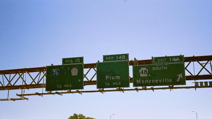
Pennsylvania Route 48 was first signed sometime in the 1920's. The current PA 48 is approximately 21 miles running in a North/South direction. It begins at PA 51 in Forward Twp. and ends at Bus US 22 in Monroeville. There are no interchanges along this road. Except for a 4 lane undivided section from PA 148 to Lincoln Way in White Oak and from Haymaker Road to US BUS 22 in Monroeville, the highway is a 2 lane rural road. Other Designations:
History:
PA 48 did not end at Monroeville. It ended at US 30, and at a different location than today. It looks like this PA 48 turned left at McKee Rd and followed this road to US 30. McKee Road intersection with US 30 is about 1.25 miles West of today's US 30/PA 48 intersection. However, Bruce Cridlebaugh has his own theory in this misc.transport.road post. Old 48 follows Long Run Rd to Lincoln Way in White Oak, turns left to follow Lincoln Way to State St/Foster Rd, and Foster Rd to Lincoln Hwy. Either way, part of today's PA 48 was numbered at one time PA 148. Then in 1931, Mosside Blvd. was opened through the Turtle Creek Valley to Monroeville. However, it wasn't until the 1940's that PA 48 moved onto Mosside Blvd. PA 48 at its longest stretched from PA 51 to Beatty Rd. in Monroeville. It later was truncated at I-376, and in 1998, it was truncated another 50 yards shorter to US BUS 22. In fact, the PA 48 North shield has been taken off signs on I-376 East. (See Image #2) In 1966, 48 was widened and somewhat straightened from PA 148 to Lincoln Way. The cost was $1.3 million. According to a photo in the June 1, 2001 edition of the McKeesport Daily News, the old stretch of highway was completely closed off during this construction. Traffic was detoured up Center St. in Versailles and either routed on Center St. Ext towards Lincoln Way or down Ripple Road to PA 48. The variation in the detour was dependent on what segment of the highway was closed. This stretch of highway's surface was completely rehabilitated in the early 1990's. Finding the old roads:
|

Image #1: PA 48's alignment in 1929 (Courtesy Bruce Harper)
|
If you have any information that can improve the accuracy of this site please e-mail me at aprince4@nc.rr.com.
Last Updated: April 1, 2003
© 1999-2003 William Lawson
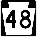
PA 48 Graphic Courtesy
Jeff Kitsko; Orange Belt and Twin Rivers graphics courtesy Bruce Cridlebaugh