 Greensboro
Bypass Photos
Greensboro
Bypass Photos
Greensboro
Bypass Photos
Greensboro
Bypass Photos
| Exit 120 & 121: I-40 & I-85 Business Split - 'The Maze' | |
| 'The Maze'
is the most complex interchange in the state, as three freeways, surface
streets, and a complex series of ramps combine together in a complex series
of metal, asphalt, and concrete. This interchange took over five
years to complete, as the series of photos below show. At this interchange,
I-85 North moves from its original alignment onto the new bypass.
Interstate 40 and 73 continue west to complete the southern half of the
loop. Connections to Business Interstate 85 and Grandover Parkway
are also made within 'The Maze'.
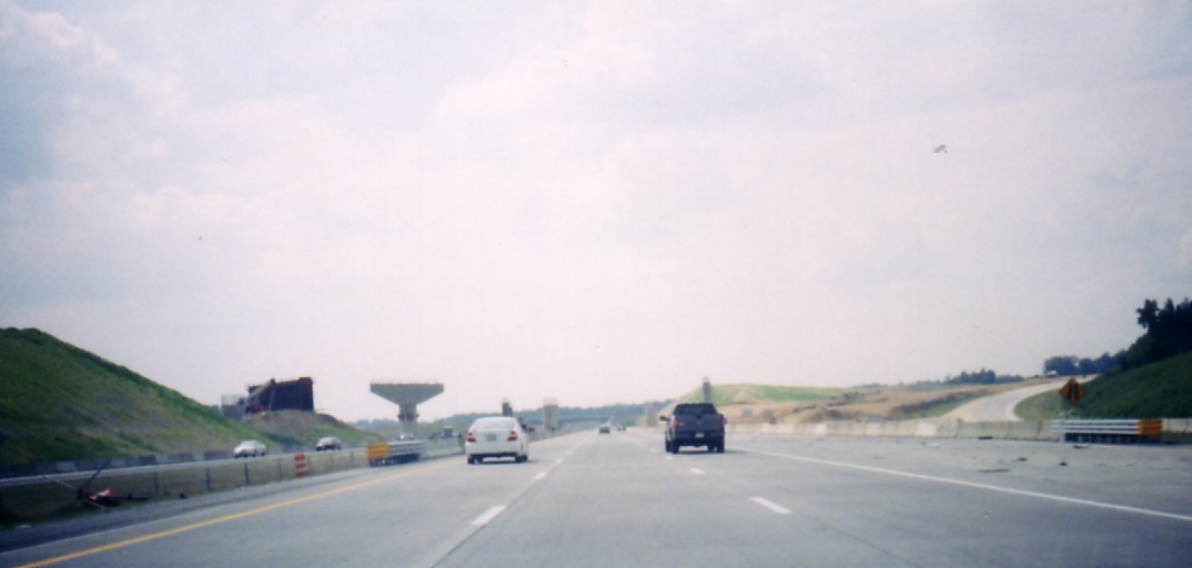
(Right photo: A view of the completed 'Maze' approaching Exit 121 from I-85 South. William Lawson; February 23, 2008) |
 |
 |
Left Image: Wide perspective
of Exit 121. Through I-85 traffic will be carried on the center carriageways.
The furthest right ramp carries traffic from I-85 South to I-85 Business
North. The left stub ramp will be carrying I-40 East traffic.
The stub ramp that dies at the hill will be the continuation of the Loop
and I-40 West. In the distance I-85 Business is carried over the
highway by twin overpasses. (Brian Polidoro; Oct. 2003)
Right Image: Closer shot of the Urban Loop/I-40 East stub ramp, stub ramp for Loop/I-40 West, and ramp carrying traffic to Business I-85 North from I-85 South. (Brian Polidoro; Oct. 2003) |
 |
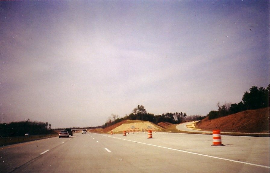 |
Left Image: From I-85
South, a look where I-85 will split from I-40 West. The orange barrels
block what will become I-40 West/I-73 North. The ramp on curving
to the far right leads to Business 85 North. (William Lawson; February 2004)
Right Image: As I-85
North approaches the new split, the old highway now exits the mainline
and crosses over the Interstate and heads towards Holden Road and Death
Valley. (William Lawson; February 2004)
|
 |
 |
Left Image: I-85 South
is ready to return to the old highway here. The old southbound lanes
run on the far right in this photo. (William Lawson; February 2004)
Right Image: The first signs for the new highway comes where a former new highway ends. This photo was taken where Business (former Temporary) I-85 meets the interstate. That is correct two Business I-85's within two miles from each other. Fortunately the interchanges have become very well marked. (William Lawson; February 2004) |
 |
 |
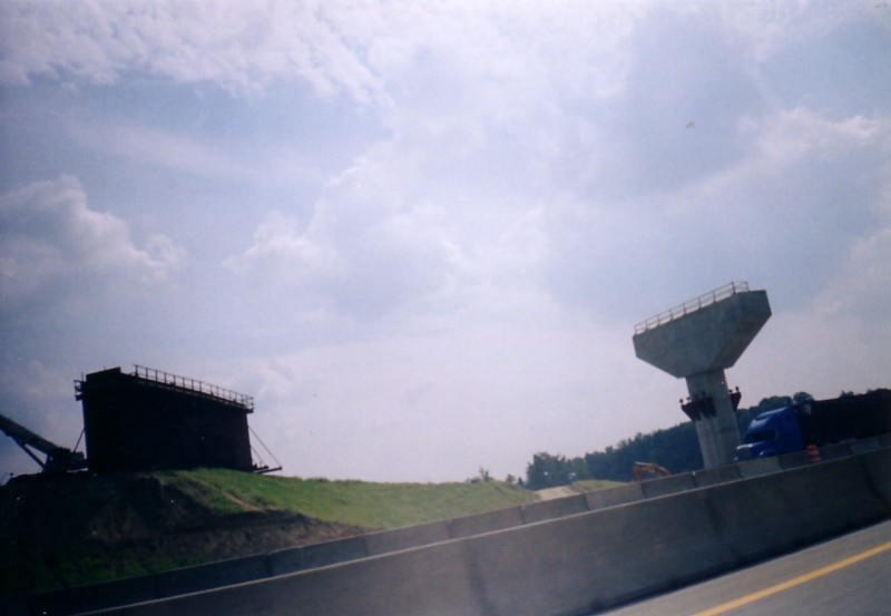
Left Image: Construction
almost began on expanding 'The Maze' immediately after the opening of the
southeast quadrant. Heading on I-85 South; this wide view of Maze
construction shows the building of some of the flyover ramps that will
be part of the massive interchange. (William Lawson; September 2004)
Right Image: A closer view of some of the bridge pier work for the interchange. (William Lawson; September 2004) |
 |
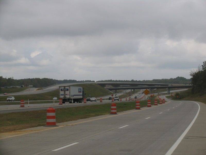 |
Left Image: Three years
later and a nearly completed maze. This view from the Grandover Ave.
off ramp shows some of the new bridges within the maze.
The highest bridge will carry I-40 East over the massive interchange and
eventually onto the loop. The lower of the two bridges will carry
traffic from I-85 North to I-40 West. (William Lawson; October 6, 2007)
Right Image: A close up look at where I-40 West and I-85 South will split. What will become I-40 West will continue on the Outer Loop while going underneath the ramp from I-85 North to I-40 West. (William Lawson; October 6, 2007) |
 |
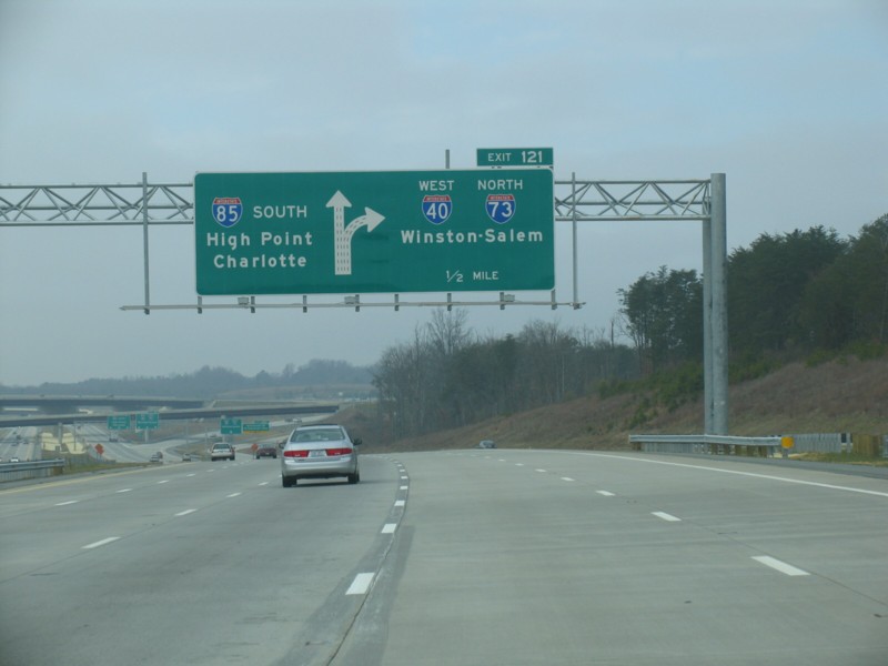 |
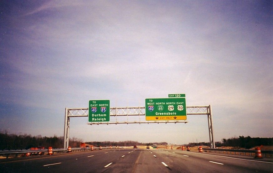
Left Image: At Exit 121, I-40 West and I-73 North 'leave' I-85 while continuing on the Greensboro Outer Loop. (William Lawson; February 23, 2008) |
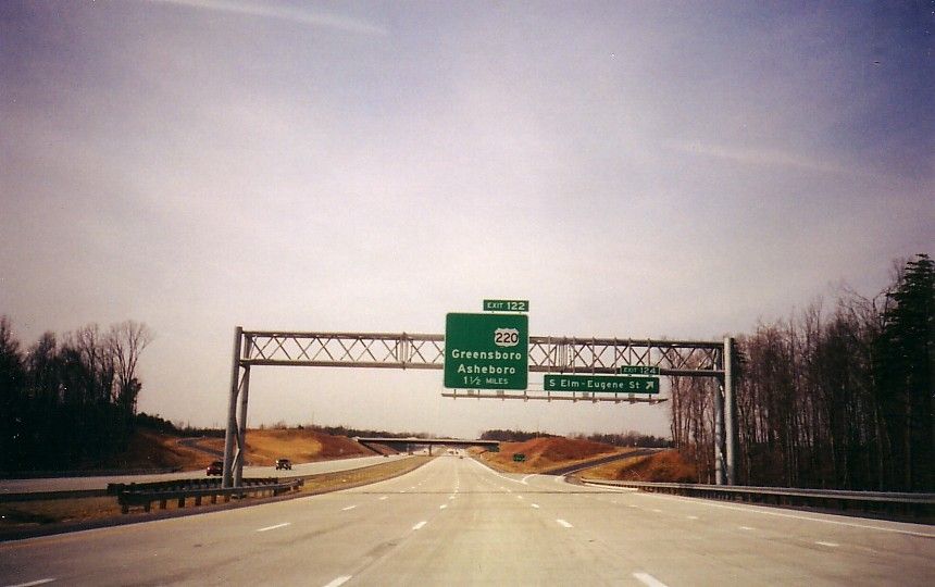
| Exit 122: I-73 / US 220 |
| The Urban Loop will be carried over this freeway and future Interstate. The design of the interchange consists of collector/distributor lanes and ramps for I-85 traffic. It is at Exit 122 where I-73 currently and mysteriously appears (or disappears depending on which direction you are traveling) onto the Greensboro Outer Loop. I-73/US 220 has C/D lanes on the I-85 Southbound/I-40 Westbound roadway. Although I-73 North is signed briefly with I-85 South and I-40 West at this point (see photo at right), traffic joining the Loop via I-73 North remain on the collector/distributor lanes until west of the I-85 South/I-40 West split. The interchange which is woven into Exit 120-1 creates one of the most complex mazes of roadways in North Carolina. (Photos below Exit 122 under construction: Brian Polidoro; Oct, 2003) | 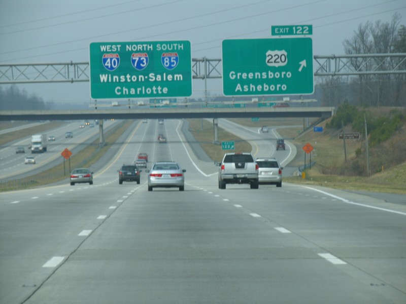 I-73 joins the Greensboro Loop at Exit 122. (William Lawson; February 23,
2008)
I-73 joins the Greensboro Loop at Exit 122. (William Lawson; February 23,
2008) |
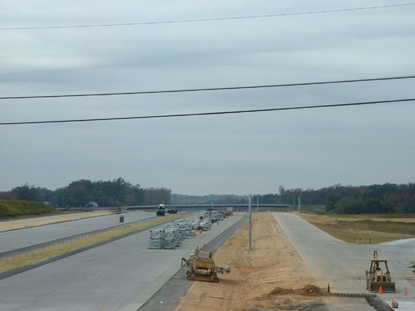 Sign
bridges are ready to be installed at the interchange. Sign
bridges are ready to be installed at the interchange. |
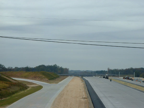 A
view of the C/D ramps used for the interchange A
view of the C/D ramps used for the interchange |
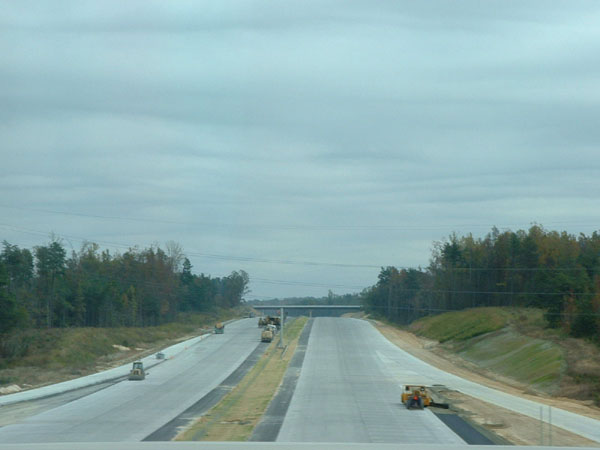 Ramps
leaving and joing I-85 as seen from Rehobeth Church Road. Ramps
leaving and joing I-85 as seen from Rehobeth Church Road. |
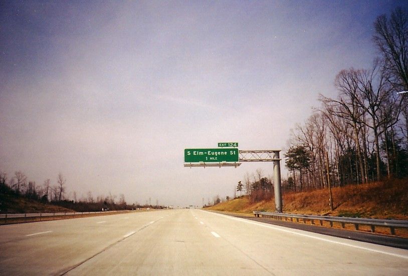
| Exit 124: S Elm - Eugene St. |
| After or before the madness of Exits 120-122 is a simple diamond interchange that serves the suburban communities south of Greensboro. |
 |
Left Image: I-85 South
is four lanes wide from Exit 126 to Exit 122 which includes an interchange
at mile 124. Ahead is 'The Maze', Exits 122-120. The empty
space to the left of the US 220 shields is reserved for I-73 South.
(William Lawson; February 2004)
Right Photo: One mile advanced notice for Exit 124. (William Lawson; February 2004) |
 |
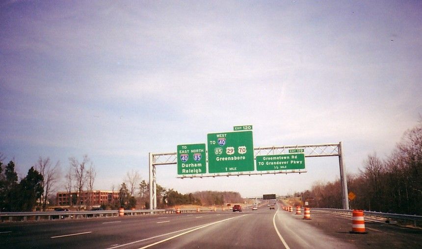
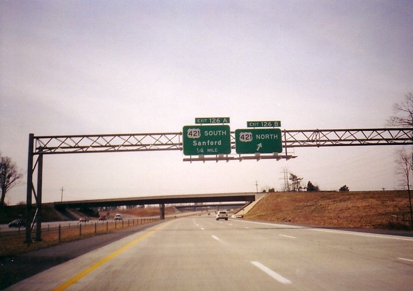
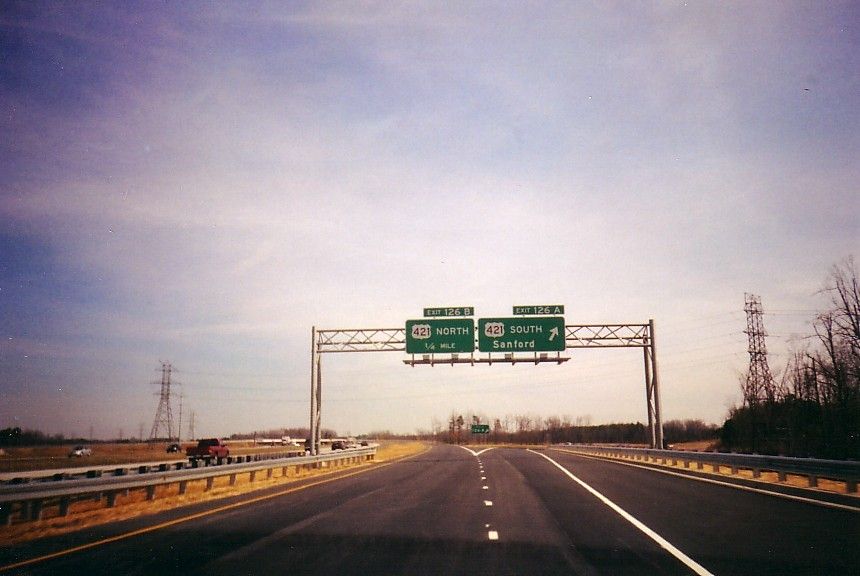
| Exit 126: US 421 |
| Another major interchange on the bypass is with US 421. This interchange connects the Interstate to points to the southeast including: Siler City, Sanford, and Fayetteville. Collector/Distributor ramps are along I-85 North. Typical Cloverleaf loop ramps exist on I-85 South. From US 421 North, a flyover ramp connects US 421 North to I-85 South. |
 |
Left Photo: At
the time the photo was taken, October 2003, work was still being done on
the ramps at this interchange. The ramp from I-85 South to US 421
North had just recently been laid with a gravel base. (Brian Polidoro;
October 2003)
Right Photo: Aprroaching the same completed and open ramp on I-85 South. (William Lawson; February 2004) |
 |
 |
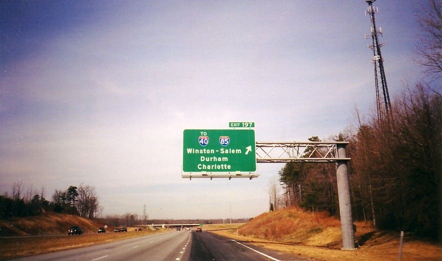
Left Image: Taken from
the collector/distributor ramps on I-85 North, these ramps are asphalt
as the main highway is concrete. (William Lawson; February 2004)
Right Image: Approaching I-85 from US 421 North. North Carolina assigns exit numbers based on mileage for all freeways including US and State Highways. In this case, this is Exit 197 on US 421. (William Lawson; February 2004) |
 |
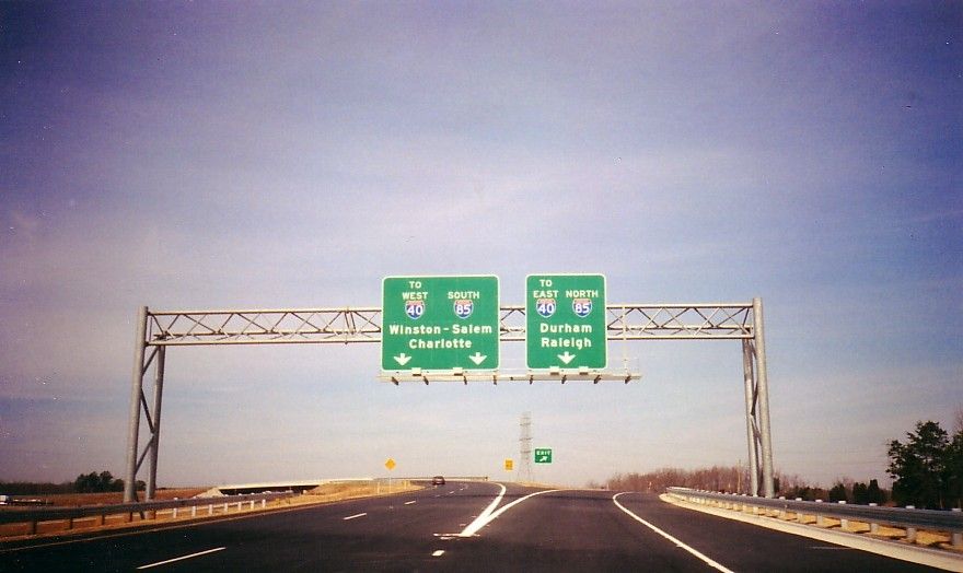 |
Left Image: The previously mentioned flyover ramp to I-85 south begins with the left ramp in this photo. Once the remainder of the southern half of the loop is complete; the 'To' heading over the I-40 shields will be removed. (William Lawson; February 2004) |
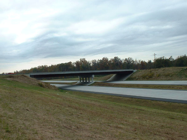
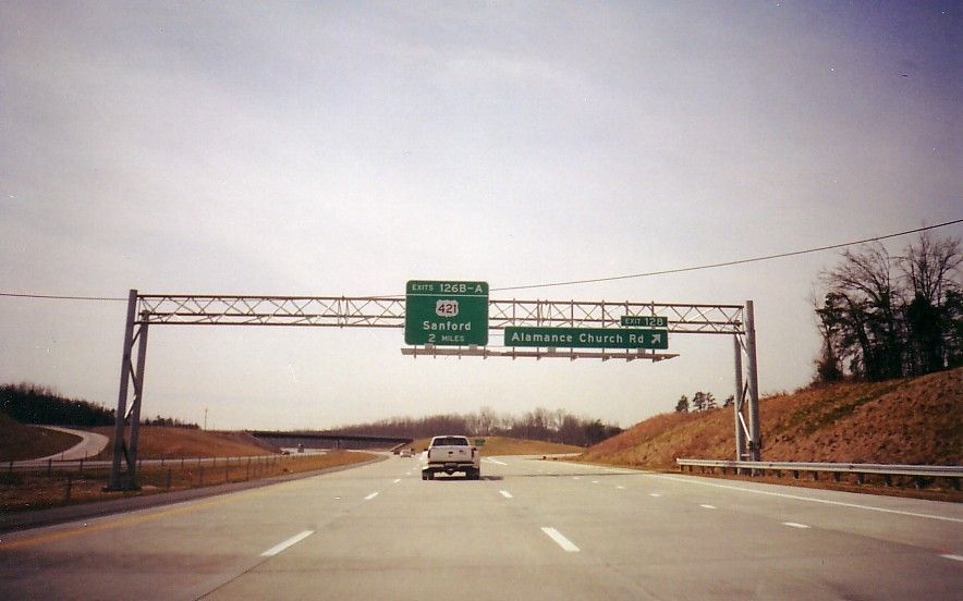
| Exit 128: Alamance Church Road |
| A diamond interchange that also serves access to Wiley-Lewis Road. |
 |
Left Image: Looking
North on I-85 from Wiley-Lewis Road. The guide sign for Alamance
Church has already been placed and awaits opening day. (Brian Polidoro;
Oct. 2003)
Right Image: I-85 runs underneath Alamance Church Road. |
 |
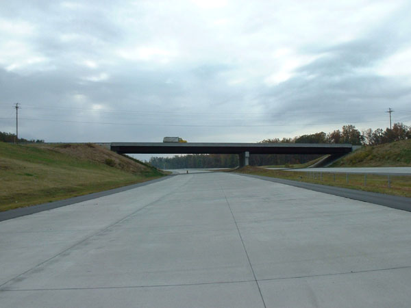 |
Left Image: Ground
level on I-85 looking 'South'. (Brian Polidoro; Oct. 2003)
Right Image: Ground level on I-85 looking 'North'. To the right is the onramp from Alamance Church Road. (Brian Polidoro; Oct. 2003) |
 |
 |
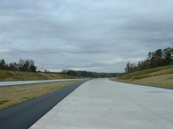
Left Image: I-85 South at Exit 128. The interchange is now complete, open and handling traffic. (William Lawson; February 2004) |
| Exit 129: Youngs Mill Road |
| The interchange with Youngs Mill Road is the new I-85's last before rejoining I-40 at Exit 131. Youngs Mill Road runs beneath the highway at this diamond interchange. |
 (Brian
Polidoro; October 2003) (Brian
Polidoro; October 2003) |
 Signs
and pavement markings at the newly opened interchange (William Lawson; February
2004) Signs
and pavement markings at the newly opened interchange (William Lawson; February
2004) |
 On
I-85 North, Exit 129 is dwarfed by the larger Exit 131 guide sign.
(William Lawson; February 2004) On
I-85 North, Exit 129 is dwarfed by the larger Exit 131 guide sign.
(William Lawson; February 2004) |
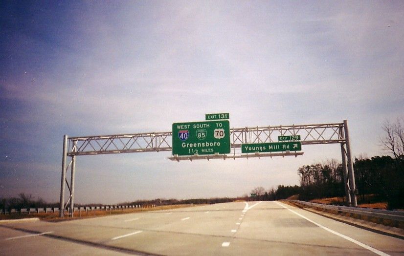
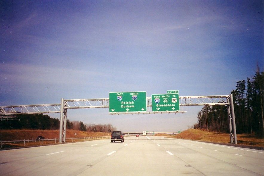
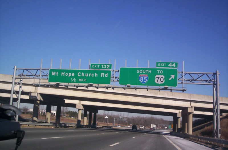
| Exit 131: I-85 Business South/ I-40/ 'TO' US 70 (Future I-840) |
| Not as complex as complex as 'The Maze' to the West, this interchange also includes ramps for Exit 132 (Mt. Hope Church Road). This interchange provides full access to I-40 East/Business I-85 South and as well to Future Interstate 840 which is a currently a short freeway that connects to US 70 less than two miles to the North. It includes flyovers and braided ramps. |
 |
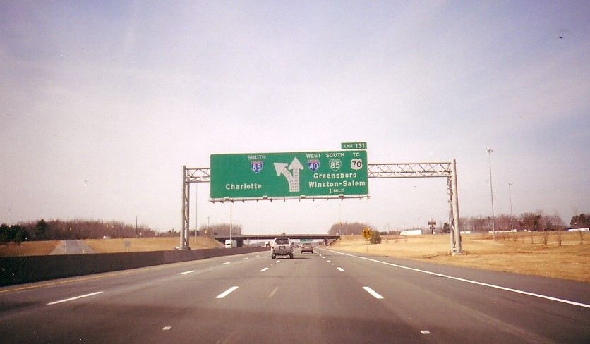
Left Image: Approaching
Exit 131 from I-85 North. I-840 will continue North via Exit 131.
(William Lawson; February 2004)
Right Image: Large overhead directional signage for the upcoming eastern I-85 split on I-85 South. (William Lawson; February 2004) |
 |
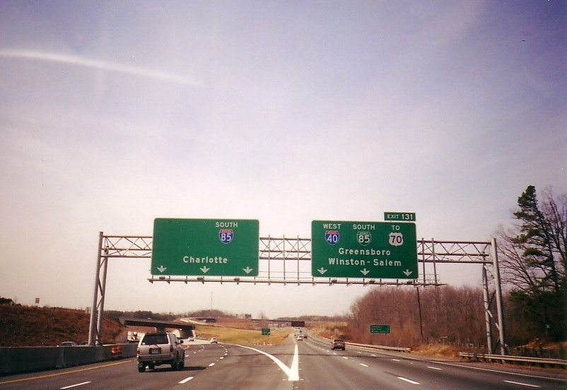 |
Left Image: Overhead
signs mark the I-85 split at Exit 131. The ramp that splits to the
right in the distance will lead to I-840. (William Lawson; February
2004)
Right Image: From I-85 Business North, Exit 44 leads traffic onto the Outer Loop. The blank space is for I-40 West, and 'TO' US 70 will eventually read I-840 West. (Billy Coore; January 2005) |
 |
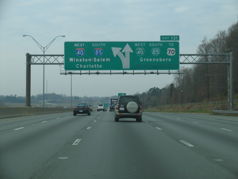 |
Left Image: With the opening of the Southwestern corner of the loop, also known as the I-40 Bypass, interchange signs were updated to reflect the new changes. I-40 now joins the Greensboro Loop with I-85 at this point. The former alignment of Interstate 40 is not Business Interstate Loop 40. (William Lawson; February 23, 2008) |
Sources & Links:
Page Created: October 28, 2003
Last Updated: March 14, 2008
© 2003-08 William
Lawson
I-85 Shield courtesy
Chris Jordan
![]()