 &
&  Connector
Photos and History of an Improvement to Pittsburgh's Highway System
& Connector
From Water Street to the Downtown
Connector:
For over a century,
the north shore of the Monongahela River has been important to the trade
and transportation of Pittsburgh. Beginning in the 1800s, Water Street
and the Monongahela Wharf combined to be the landing point for commerce
and trade. Water Street which ran above the slopes of the wharf was
full of warehouses and office buildings. As the automobile era grew
stronger into the 1940s, city leaders planned and then built Ft. Pitt Boulevard,
an elevated roadway that improved and segregated traffic flow from the
Wharf. The completion of the Penn-Lincoln Parkway in the 1950's
added to the maze of highways, as the Boulevard became more important to
the Central Business District traffic compared to the through traffic of
the parkway on ground level. In 1968, the completion of the Fort
Duquesne Bridge brought new levels of traffic to Ft. Pitt Boulevard.
The Boulevard was used for traffic coming from the North Shore and the
bridge wishing to connect to the Parkway East towards Oakland and Monroeville.
By the mid-1990s, the condition of the roadway had deteriorated where one
of the three eastbound lanes were closed for safety concerns. The
concern over the rehabilitation of the Ft. Pitt Bridge and the desire to
have a seamless flow between the Interstates initiated talk and the eventual
construction of the connector in 2001-2002.
The construction which was accelerated because of the immediate needs in the area also included the rehabilitation of Ft. Pitt Boulevard which had not seen any major improvements since opening in the 1940s. The three eastbound lanes for Ft. Pitt Blvd. was realigned to include two lanes used exclusively for local traffic and signaled intersections. The third lane was isolated for signal free and quick access to I-376. Construction also included a 12 foot sidewalk that improved access to Point State Park and the Eliza Furnace Trail.
 |
Just after crossing the Allegheny River, the connector begins underneath the Ft. Pitt Bridge. In the past, both lanes led to Ft. Pitt Boulevard. Photo taken by Ed Szuba, August 31, 2003 |
 |
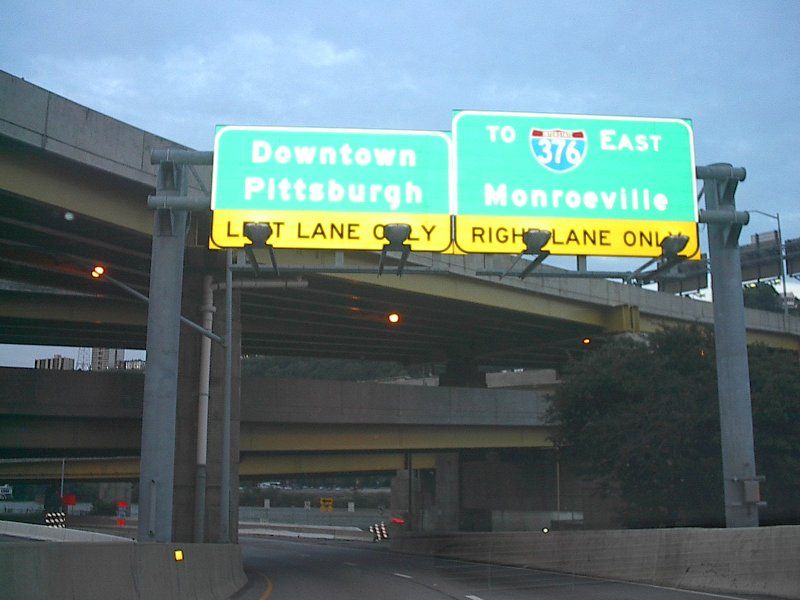
The Downtown Connector approaching the Ft. Pitt Boulevard split. The right lane splits for the traffic signal free smooth connection to I-376 East. The two left lanes lead to Ft. Pitt Boulevard. Photo taken by Ed Szuba, August 31, 2003. |
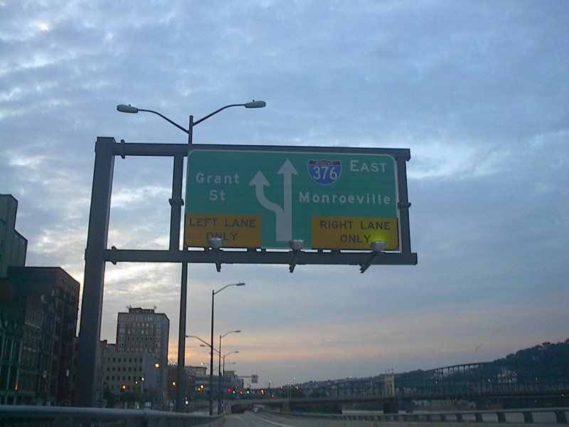 |
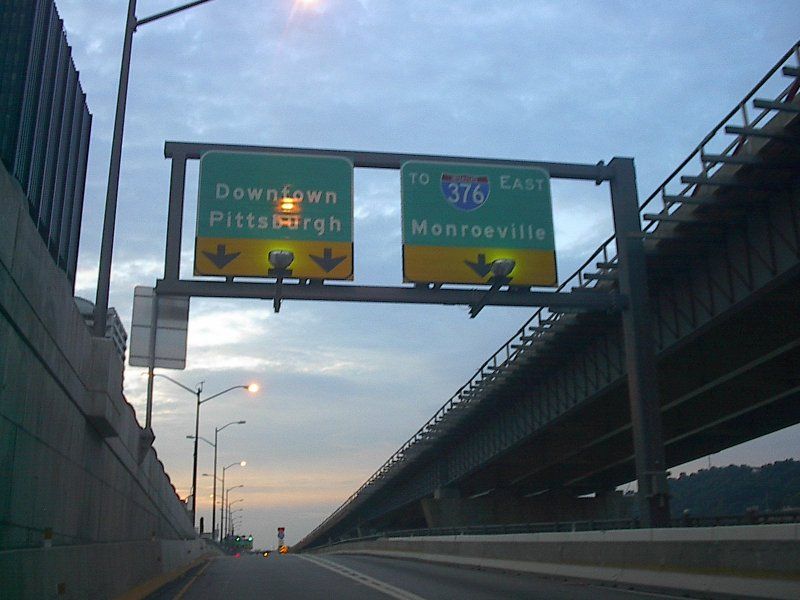
Along Ft. Pitt Blvd., this overhead shows another split. Ft. Pitt Boulevard still provides access to Interstate 376, allowing many First Side streets to access the Parkway. Ft. Pitt Boulevard ends at Grant Street. Photo taken by Ed Szuba, August 31, 2003. |
Page Created: January 25, 2004
Last Updated: January 26, 2004
(C) 2004 William Lawson
I-279 & 376
Shields coutesy Jeff Kitsko