
Red Belt Ends
Red Belt Ends
The Red Belt
is exclusive to the extreme northern parts of Allegheny County. A
highway connection from the Ohio River eastwards to the Allegheny.
The Red Belt's 30 mile length has grown increasingly important with the
rapid growth in the North Hills and Cranberry Township (Butler County).
Denny Pine took all photos of the termini of the Red Belt.
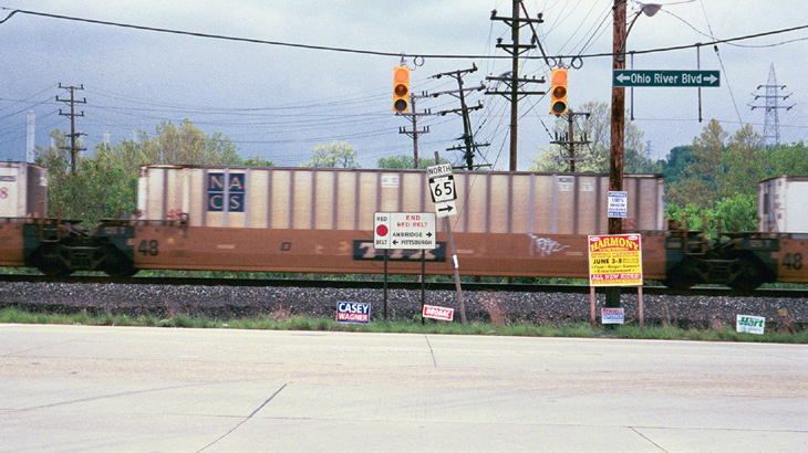
Just inside the Allegheny County line between Leetsdale and Ambridge is the west end of the Red Belt. Like the Green and Orange Belts, the Red Belt also ends at a PA state route, PA 65.

On PA 65 South a 'Begin' Red Belt sign can be found. The US 19 shield is found commonly with the Red Belt as it is a preferred connection to the busy spine route of the North Hills.

The east end of the Red Belt is at the intersection of Bull Creek Road and PA 366 in Tarentum. The bridge in the photo carries PA 366 over the Allegheny and into New Kensington, Westmoreland County.
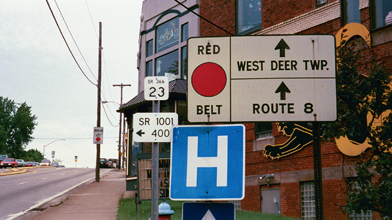
The photos above and below show the first red belt signs on PA 366.

Page Created: August 10, 2002
Last Updated: August 10, 2002
(C) 2002 William Lawson