|
|
Northwest Loop Photos |
 The
next few segments of the Outerbelt to open will complete the Northwest
Loop. Plagued with errors, communication issues, and bad luck the
nearly fifteen mile segment in some places is over a year behind schedule.
The Northwest Loop will be opened in three segments. The first -
nearly two and a half miles of highway from Interstate 85 to NC 27 (Mount
Holly Road) - opened in December 2006. The following May, the highway
extended further north to Brookshire Blvd. (NC 16). Finally, the
highway will open to Interstate 77 and NC 115 near Huntersville by the
Summer of 2008.
The
next few segments of the Outerbelt to open will complete the Northwest
Loop. Plagued with errors, communication issues, and bad luck the
nearly fifteen mile segment in some places is over a year behind schedule.
The Northwest Loop will be opened in three segments. The first -
nearly two and a half miles of highway from Interstate 85 to NC 27 (Mount
Holly Road) - opened in December 2006. The following May, the highway
extended further north to Brookshire Blvd. (NC 16). Finally, the
highway will open to Interstate 77 and NC 115 near Huntersville by the
Summer of 2008.
I-485's completion to Interstate 77 will be
another important link in Charlotte's transportation network. The
completed northwest corner will allow southbound drivers to Gastonia, South
Carolina's Upstate, or Atlanta, Georgia to bypass heavier traffic approaching
Charlotte and leaving the city towards Gaston County. It will also
cut about five to seven miles of driving and at least 15 minutes of traffic
if not more.
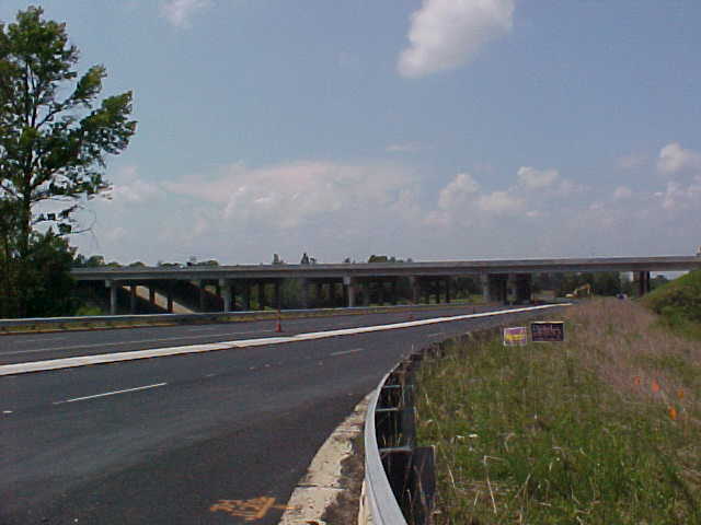
| Exit 10 - Interstate 85 | ||
 |
Left Image: From the I-485
North to I-85 South ramp, a look at Exit 10. The far right lanes
are for the collector/distributor setup to handle Exit 10 and Exit 9.
This is looking southwards with Interstate 85 crossing over the highway.
(Photo taken by Lyndon Young; September 2006)
Right Image: Looking North from the same ramp. (Photo taken by Lyndon Young; September 2006) |
 |
| Exit 12 - Moores Chapel Road | ||
| The interchange with Moores Chapel Road is a typical diamond interchange. However, there is one twist to this set up. At the intersections at the end of both sets of offramps, roundabouts are present versus the more common signalized or stop sign controlled intersection. The roundabouts have been open to traffic since September 2004. | ||
 |
Left Image: From the Moores
Chapel Road overpass looking south. At the time, I-485 still needed
line painting to be done. (Photo taken by Lyndon Young; September
2006)
Right Image: Looking North from the same overpass. (Photo taken by Lyndon Young; September 2006) |
 |
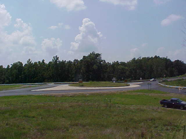 |
Left Image: An elevated view
at one of the roundabouts at the Moores Chapel Road interchange.
As you can see a complete circle cannot be made at this roundabout.
If you need to reverse direction, you have to loop around the complimentary
roundabout. (Photo taken by Lyndon Young; September 2006)
Right Image: A ground level view at one of the roundabouts. (Photo taken by Lyndon Young; September 2006) |
 |
 |
Left Image: Approaching
Exit 12 from I-485 North/Inner from the I-85 interchange. At the
time of this photograph, I-485 only continued two miles further to Exit
14 and NC 27. (Photo taken by William Lawson; April 9, 2007)
Right Image: This time the signs at Exit 12 along I-485 South/Outer. The other guide sign combines Exit 10 (I-85) and Exit 9 (US 29/74) on one sign, as access to both exits are from the same off-ramp. (Photo taken by William Lawson; April 9, 2007) |
 |
 |
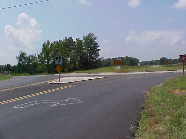
Left Image: A guide sign on
Moores Chapel Road diagrams one of the interchange's two roundabouts and
their destinations. (Photo taken by William Lawson; April 9, 2007)
Right Image: Interstate shields at the onramp from Moores Chapel Road to I-485 South/Outer shows how the uniquely named loop is signed. (Photo taken by William Lawson; April 9, 2007) |
 |
| Exit 14 - NC 27 (Mount Holly Road) | ||
| Because of the terrain and CSX rail tracks, Exit 14 is a folded diamond interchange. Interstate 485 crosses over both the railroad and NC 27 at this interchange. | ||
 |
Left Image: From NC 27
looking at I-485 crossing over both the CSX railroad tracks (on the left)
and NC 27. (Photo taken by Lyndon Young; September 2006)
Right Image: Here you see the offramp (left) and onramp (right) from and to I-485 North. (Photo taken by Lyndon Young; September 2006) |
 |
 |
Left Image: Approaching Exit
14 from I-485 North/Inner. This photo was taken not long after I-485
was extended another two miles to NC 16. (Photo taken by Chris Curley;
May 16, 2007)
Right Image: From the opposite lanes of I-485 South/Outer an offramp leads to NC 27/Mt. Holly Road at Exit 14. (Photo taken by Chris Curley; May 16, 2007) |
 |
| Exit 16 - NC 16 (Brookshire Blvd.) | ||
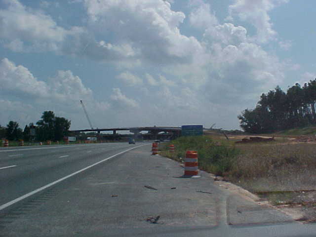
| I-485's interchange with NC 16 is a partial cloverleaf. The highway opened from Exit 14 to this point in May 2007. At right is a photo of the then still under construction I-485 crossing over Brookshire Blvd. in September 2006 by Lyndon Young. | 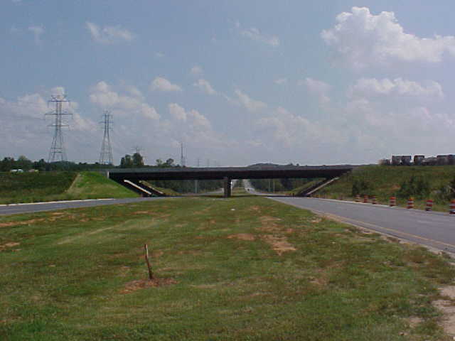 |
|
 |
Left Image: North/Outer I-485
comes to a new end at Brookshire Boulevard (Exit 16). (Photo taken
by Chris Curley; May 16, 2007)
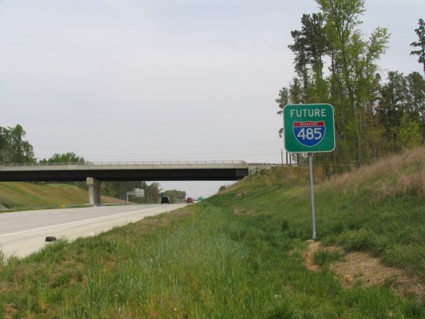
Right Image: Parts of I-485 headed towards I-77 in Huntersville lie dormant north of Exit 16. Motorists will not be able to use this part of the highway until at least the Summer of 2008. (Photo taken by Chris Curley; May 16, 2007) |
 |
| Exit
18 - Oakdale Road (Future Interchange)
Exit 21 - W. T. Harris Blvd. |
||
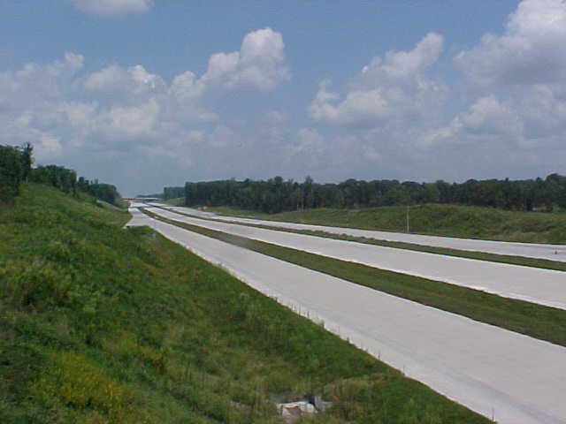
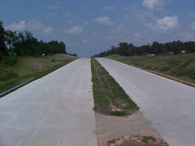
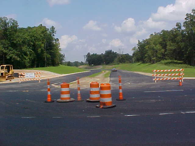
| Currently, I do not have photos of either interchange. The interchange with Oakdale will be graded for eventual use but it will not be open when the highway is completed through here in late 2007. The Oakdale Road interchange will be similar to the Moores Chapel Road exit. Like Exit 11, there will be roundabouts at the end of each set of ramps. Below are photos of I-485 being built over Beatties Ford Road, which is between exits 19 and 22. | ||
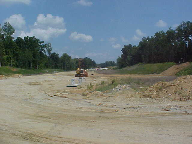 |
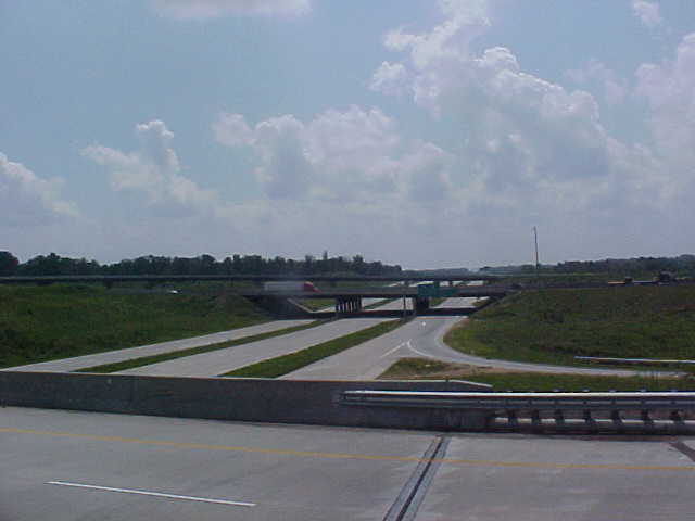
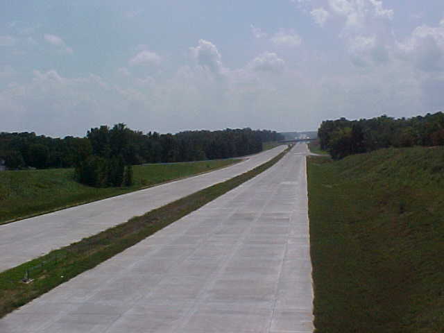
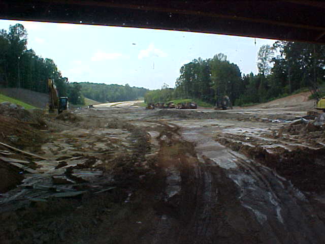
Left Image: Looking south towards
Oakdale Road from where I-485 will cross over Beatties Ford Road.
A pair of completed bridges that will carry the Outerbelt can be seen in
the background. (Photo taken by Lyndon Young; September 2006)
Right Image: Looking north from the same spot. The bridge at the top of the photo will carry Beatties Ford Road over Interstate 485. (Photo taken by Lyndon Young; September 2006) |
 |
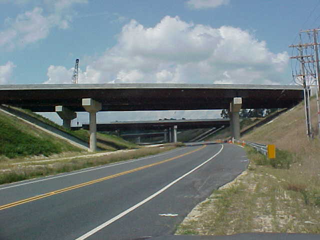
| Exit 23 - Interstate 77 & NC 115 | ||
| The Outerbelt's interchange with I-77 will be a high-speed modified stack interchange similar to Exit 10 with I-85. Sweeping flyover ramps will carry traffic over I-77 to the new outerbelt along with traditional loop ramps. | ||
 |
Left Image: Looking at
the I-485/I-77 interchange under construction from I-77 South. (Photo
taken by Lyndon Young; September 2006)
Right Image: From US 21 North, a series of bridges carry I-485 and the ramps from Exit 24. Interstate 77 is only a few hundred yards to the left. (Photo taken by Lyndon Young; September 2006) |
 |
Sources & Links:
Page Created: October 11, 2006
Last Updated: October 20, 2007
© 2006-07 William Lawson