 |
Old NC 10 - The Central
Highway:
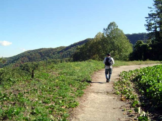
Old Fort to Black Mountain through the Royal Gorge. Header photo: The webmaster hiking the Central Highway at Point Lookout. (Photo credit: Dave Filpus) |
|
Old NC 10 - The Central
Highway:
Old Fort to Black Mountain through the Royal Gorge. Header photo: The webmaster hiking the Central Highway at Point Lookout. (Photo credit: Dave Filpus) |
A unique way
of tracing the remnants of the Central Highway is through the mountainous
terrain of Eastern Buncombe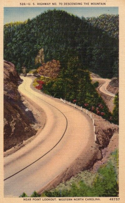 and Western McDowell Counties. From the east on US 70, you reach
the base of Blue Ridge Mountains at the town of Old Fort. Old Fort
is a tiny rail town that the old Central Highway and now US 70 goes through.
The Central Highway can be followed via a right onto Mill Creek Road from
US 70. Follow the highway as it takes you closer to the mountains.
When Mill Creek Road bears right to head towards Andrews Geyser stay straight
until the road ends at a gate. The nearby Piney Grove Church can
be used for parking. At this point, the old Central Highway began
a 3.5 mile climb of the mountain to Swannanoa Gap. NC 10 and later
US 70 travelers followed this road for over 30 years until a new and modern
four lane US 70 was built to the south. This same four lane road
would eventually become Interstate 40.
and Western McDowell Counties. From the east on US 70, you reach
the base of Blue Ridge Mountains at the town of Old Fort. Old Fort
is a tiny rail town that the old Central Highway and now US 70 goes through.
The Central Highway can be followed via a right onto Mill Creek Road from
US 70. Follow the highway as it takes you closer to the mountains.
When Mill Creek Road bears right to head towards Andrews Geyser stay straight
until the road ends at a gate. The nearby Piney Grove Church can
be used for parking. At this point, the old Central Highway began
a 3.5 mile climb of the mountain to Swannanoa Gap. NC 10 and later
US 70 travelers followed this road for over 30 years until a new and modern
four lane US 70 was built to the south. This same four lane road
would eventually become Interstate 40.
The Central Highway through this area began as an old stage route that climbed the mountain near the tracks of the Western North Carolina Railroad. The rail line's ascent up the mountain featured the 1800' Swannanoa Tunnel. The old Central Highway crosses over the tunnel near the crest of the mountain. Once at Swannanoa Gap, the Central Highway descended down the mountain towards Ridgecrest and eventually Black Mountain. Although the old Central Highway has been barricaded of for several years, it has become quite popular by local residents and travelers alike who hike and bike along the winding cement pavement. Amazingly the old road is very passable, save for downed trees and overgrowth. Remarkably, in some cases old pavement markings are still visible. The three and a half miles of abandoned highway ends near Swannanoa Gap with another barricade as the road returns - although sparingly for auto use. (Note: This western gate is marked as Private Property. It appears that the former highway is on private land for about a 1/2 mile from the Swannanoa Rail Tunnel to the west gate.)
I have been fortunate to hike this old highway in October of 2001 and 2007. It is a very easy hike but do bring water and snacks as the grade and length of the hike can get tiring over time. Residents near the old highway are very friendly and always willing to say hello and tell you about the old road. Be sure to bring your camera as the views from Point Lookout and along the old highway are very scenic. Old Central Highway
Photos:
|
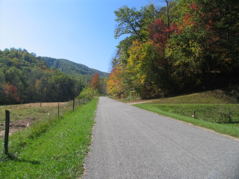 |
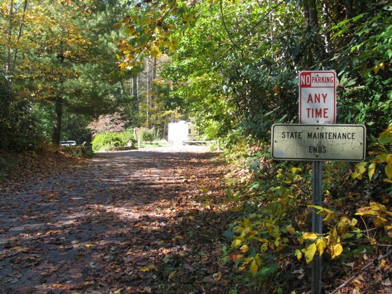
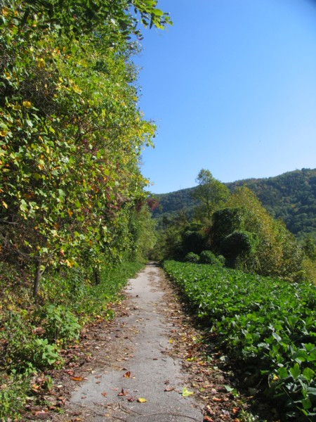
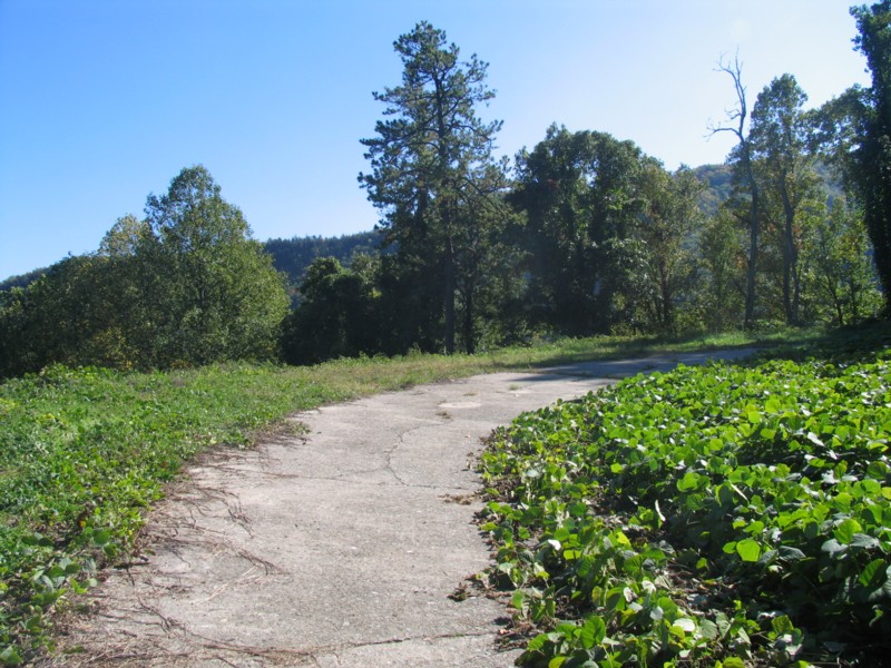
Left Photo: The old
Central Highway runs through the quiet rural NC countryside.
Right Photo: A 'State Maintenance Ends' sign and barricade marks the end of the vehicular access of the old Central Highway. The hike begins here. |
 |
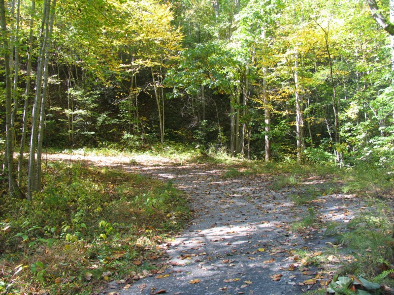 |
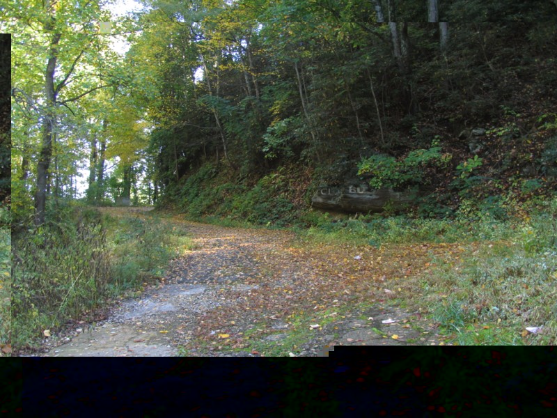
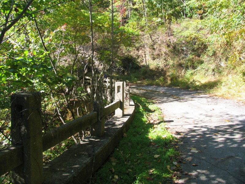
Left and Right Photos: The former Central Highway winds its way up the mountain. For the most part, the pavement of the old road is still in excellent shape even with overgrowth extending onto the former right-of-way. | 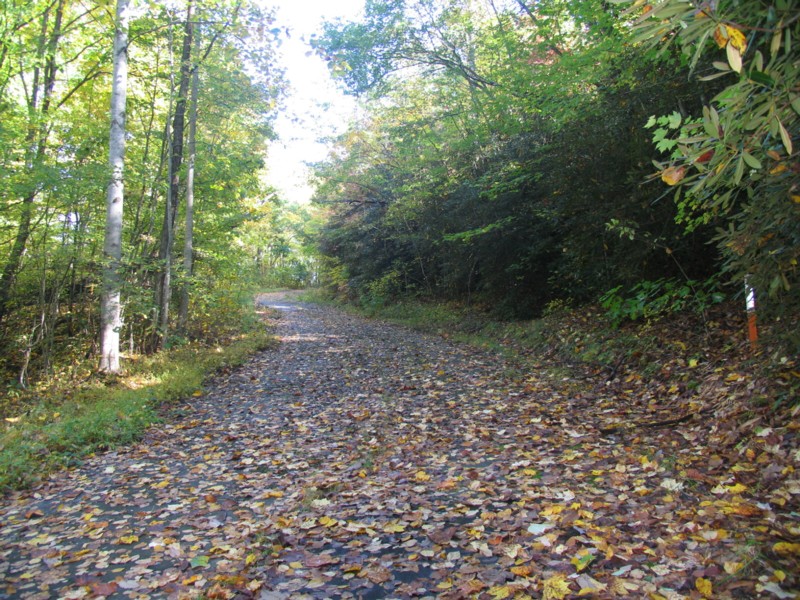 |
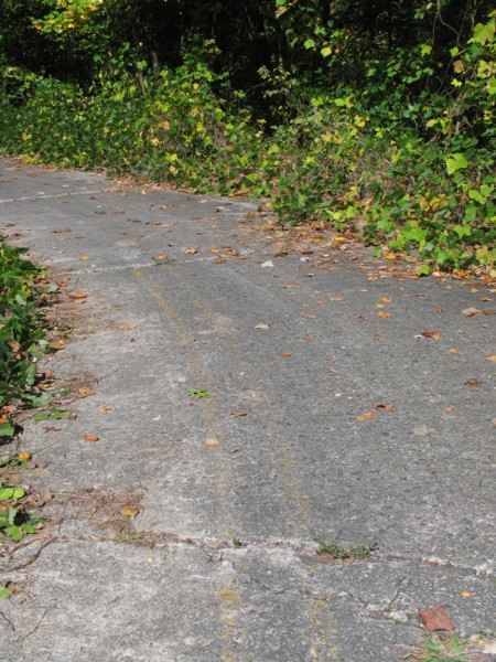 |
Left Photo: Even after
numerous years without traffic, the double yellow striping on the old highway
still can be seen.
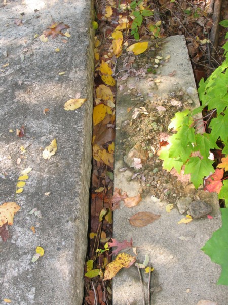
Right Photo: An old drainage culvert. The old concrete highway sits to the left. |
 |
 |
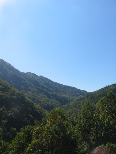
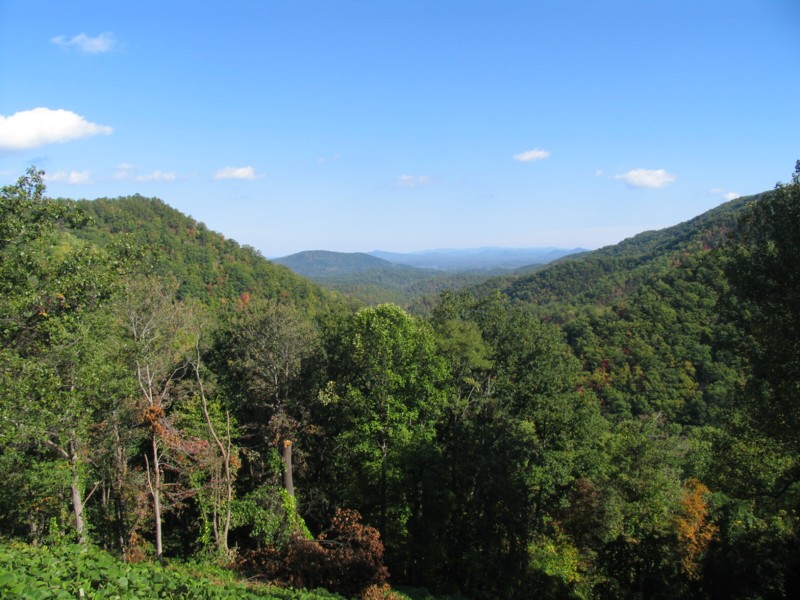
Left Photo: Nearly
overrun by Kudzu, the Old Central Highway reaches a clearing along the
mountainside giving...
Right Photo: ...this great view of the Royal Gorge. |
 |
 |
Left Image: A 1920s
era linen postcard of the Central Highway and the Royal Gorge.
Right Photo: The old Central Highway continues to climb near Point Lookout. |
 |
 |
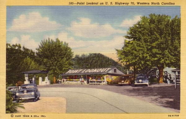
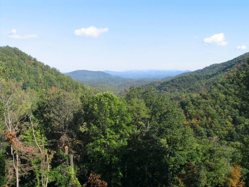
Left Photo: The Central
Highway curves at Point Lookout. The former Point Lookout tourist
stop was on the left.
Right Photo: One of the main attractions to Point Lookout was the remarkable view of Royal Gorge. |
 |
 |
Left Image: A vintage
linen postcard of the view of Royal Gorge from Point Lookout.
Right Photo: Another 2007 view of Royal Gorge also from Point Lookout. |
 |
 |
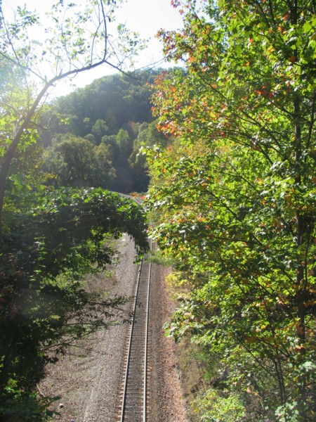
Left Photo: One of
the few remnants of the old highway is this double concrete guide rail
just beyond Point Lookout. Below, the former Western Carolina Railroad,
now Southern Railroad, enters the Swannanoa Tunnel.
Right Image: A classic linen postcard showing the Swannanoa Tunnel and the Central Highway above the portal. |
 |
 |
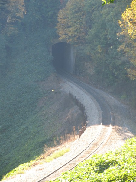
Left Photo: The single
track rail line is still used today.
Right Photo: As seen from the Central Highway, another rail tunnel just west of the Swannanoa Tunnel. |
 |
| Site Navigation:
Sources & Links:
Page Created: September 5, 2005
© 2008 William Lawson |