 Over
70 years ago, two hurricanes drastically changed the terrain that surrounds
the New Point Comfort Lighthouse. These two storms - which hit less
than one month apart - would isolate the storied New Point Comfort Lighthouse
from the mainland by one half mile. These 1933 hurricanes, along
with similar storms, invasions, and other incidents before and after, have
threatened or even severely damaged the lighthouse. But for over
200 years, the beacon has stood watch over the Chesapeake Bay and has become
a familiar friend to boaters, tourists, and residents alike. Over
70 years ago, two hurricanes drastically changed the terrain that surrounds
the New Point Comfort Lighthouse. These two storms - which hit less
than one month apart - would isolate the storied New Point Comfort Lighthouse
from the mainland by one half mile. These 1933 hurricanes, along
with similar storms, invasions, and other incidents before and after, have
threatened or even severely damaged the lighthouse. But for over
200 years, the beacon has stood watch over the Chesapeake Bay and has become
a familiar friend to boaters, tourists, and residents alike.
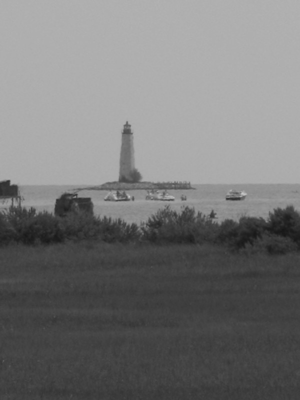
At the end of the 18th century, the United States government had realized the importance of improving the navigation through the Chesapeake Bay to the numerous ports the bay's waters led to. Beginning with the completion of the Port Henry lighthouse in 1792 (1), the government would commission a series of lighthouses with the goal of improving safety and navigation through the Chesapeake. A decade later, the Old Point Comfort Lighthouse was completed by Elzy Burroughs. That same year, Burroughs was again commissioned to build a third Chesapeake lighthouse at the tip of the New Point Comfort Peninsula, slightly north of the entrance to Mobjack Bay. (2) Burroughs would build the lighthouse through three damaging hurricanes in 1803 and 1804. The New Point Comfort Light began service on January 17, 1805 when Burroughs first lit the oil lantern. The completed lighthouse stands at a height of 58 feet and has an octagonal shape. The structure was built completely out of sandstone, and its design closely resembles the two Chesapeake lighthouses that preceded it, Old Point Comfort and Port Henry. For over the next century, the New Point Comfort light weathered a series of storms by both nature and man. Less than a decade after Burroughs completed the structure, the light was captured by the British in the War of 1812. Held by the British Army for only four weeks, the army ransacked the grounds, burned down the lightkeeper's house and oil vault, and did considerable damage to the lantern and the lighthouse itself. Burroughs was asked to repair the grounds, light and rebuild the keeper's home.(1) Nearly fifty years later, another war, the U.S. Civil War, brought damage to the lighthouse. Confederate troops rendered the light inoperable in an attempt to hamper Union shipping through the Chesapeake. Although the damage was significant, it was less than the damage done by the British years before.
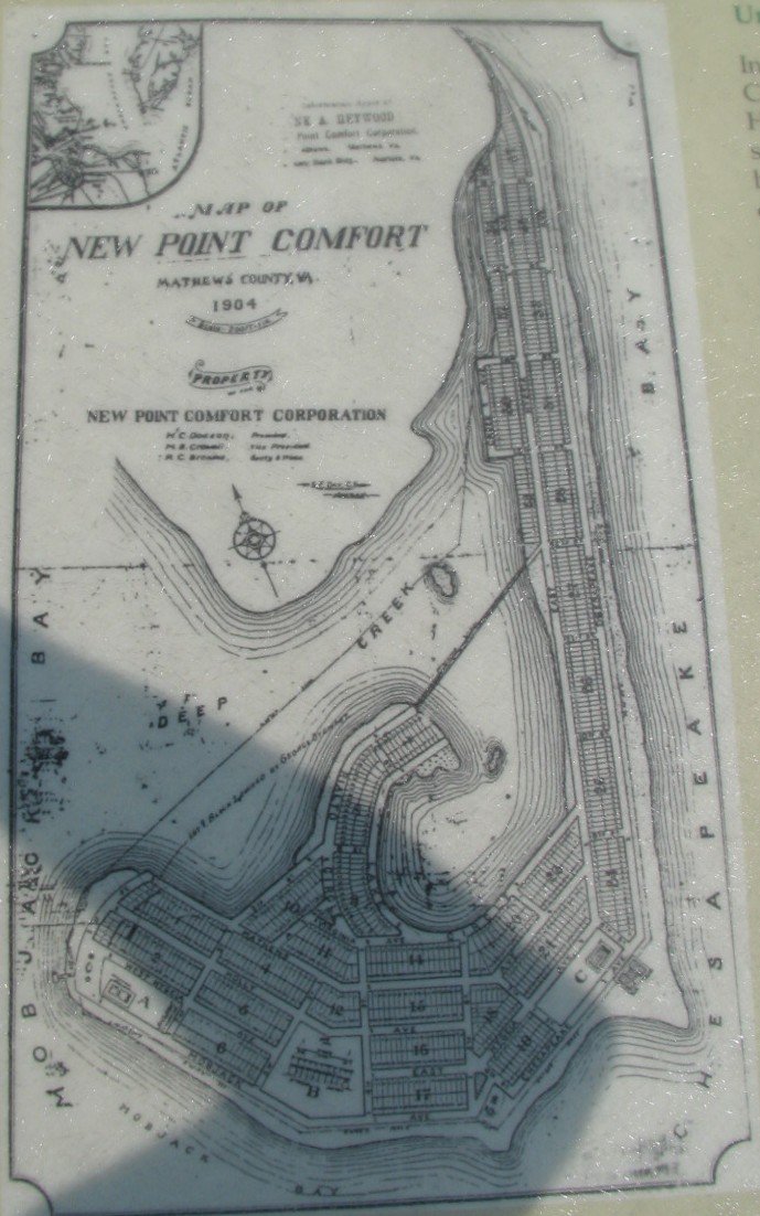
Weather would leave the biggest impact to the fragile peninsula. Hurricanes and Nor'Easters would continue to eat away at the shoreline. In 1847, the storms began the formation of a new inlet slightly north of the lighthouse. Five years later, the inlet had cut through the peninsula and the lighthouse now was the focal point of a new island. (The inlet can be seen at the top right corner of the 1904 map.) However, Mother Nature's biggest blow came from the wrath of two successive hurricanes in 1933. The first storm on August 23, 1933 crossed directly over the Chesapeake. Less than a month later on September 16th, a second hurricane would move off the Virginia Coast, and although this storm did not cross over the Chesapeake, heavy winds and storm surge affected the bay. The results of these two storms, twenty-four days apart, on New Point Comfort and the peninsula were devastating. The lighthouse - still standing - now sat on its own tiny island a half mile south of the mainland. A second island remained between the lighthouse and the tip of the peninsula. If the 1904 development was built, the damage to the area would have been even greater. The United States Coast Guard took over lighthouse operations six years later in 1939. For the next 24 years, many drastic changes to the operation of the lighthouse occurred. In 1950, the light, which was converted to gas in 1919, now ran by electricity. The Coast Guard built a new light called the 'New Point Comfort Spit Light' in 1963. Burrough's lighthouse - with limited interruptions since 1805 - was then abandoned.
Today, the lighthouse is still subject to vandalism.
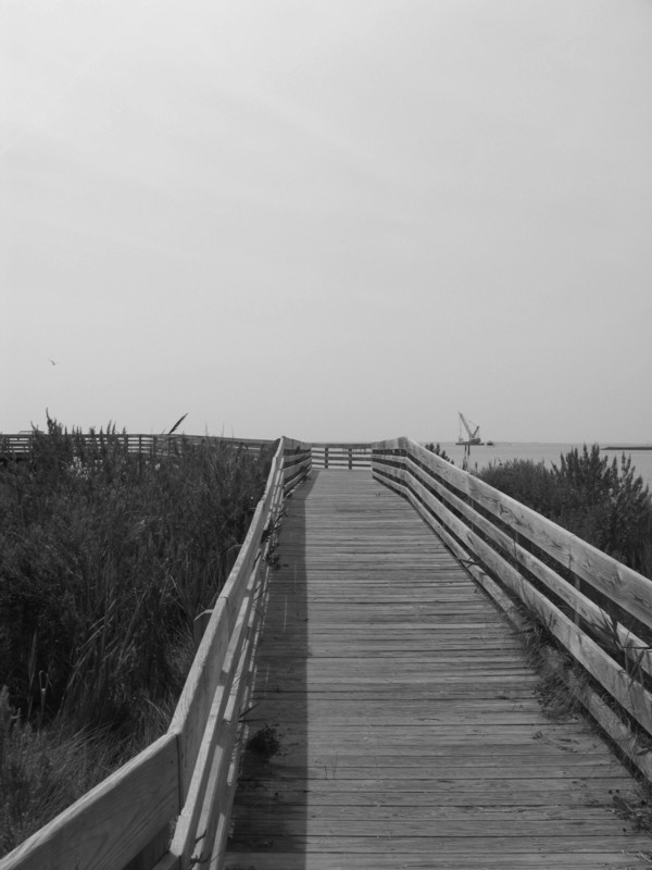
There is no direct or safe public access to the island or the lighthouse.
However, it is accessible by boat. To compensate for the lack of
public access, a boardwalk (shown at right) was constructed at the southern
tip of the peninsula within the New Point Comfort Preserve. The boardwalk
allows for great views of the Chesapeake, surrounding salt marshes, native
wildlife, and of course the New Point Comfort Lighthouse.
Directions:
Additional Photos:
|
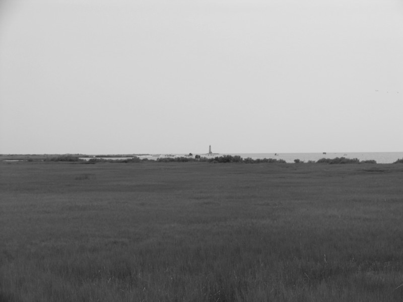 From
the boardwalk and across the salt marshes, the New Point Comfort Lighthouse. From
the boardwalk and across the salt marshes, the New Point Comfort Lighthouse. |
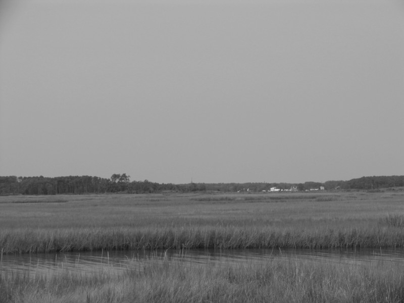 Preservation
of the salt marshes is a key concern of the New Point Comfort Preserve. Preservation
of the salt marshes is a key concern of the New Point Comfort Preserve. |
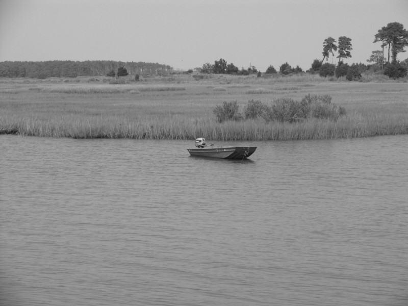 An
example of the serene surroundings, a small boat sits quietly in the water. An
example of the serene surroundings, a small boat sits quietly in the water. |
| Site Navigation:
© 2006 William Lawson |