The National Road:
Ohio
Belmont County
| Us
40 through eastern Ohio traverses a changing landscape. It enters
the state at Bridgeport, a town with a strong industrial background.
It continues west into smaller cities like St. Clairsville and then onto
the rural towns of Fairview and Old Washington. This segment of the
old National Road and US 40 has a little bit of everything from old alignments
containing original brick pavement, stone 'S' Bridges, and a dead
end at the foot of a modern Interstate 70. US 40 is truly a backroad
as it parallels and ultimately forgotten by the hustling traffic on the
Interstate.
St.
Clairsville is one of these towns that the old highway serves as 'Main
Street.' St. Clairsville serves as the Belmont County seat and the
historic Belmont County Courthouse (shown below) is located on US 40.
St. Clairsville also has the National Road Bikeway. The bikeway is
a 7.7 mile rail-trail that runs north-south and tunnels underneath route
40. It opened in 1998. |

(Doug Kerr) |
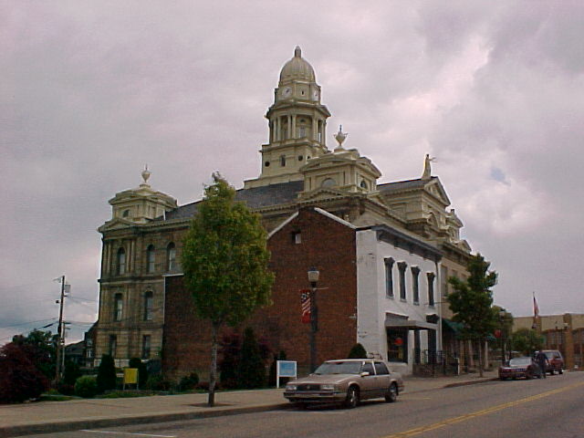
Belmont County Courthouse
(Mike Austing)
| Throughout Belmont
County, there are numerous old alignments of the National Road and Route
40. One of these old paths bears off the highway near Ohio University's
Belmont Campus. Known as Belmont County Route 40W, this narrow and
forgotten road leads to Lloydsville, a town younger than the road that
runs by it. Lloydsville
was incorporated in 1962. However, Lloydsville was at least known
as far back as 1920. (1) To reach this old alignment of US 40, leave
I-70 at Exit 213 and head west on route 40. About 1/4 mile
past the OU-Belmont Campus, turn left towards Lloydsville, and you'll be
on County Route 40W, former US 40! |
(Mike Austing) |
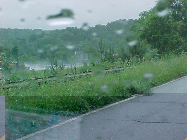
Just west of
Morristown, the original US 40 is literally stopped by a hillside and a
pond. When Interstate 70 was completed in the area in the 1960s,
US 40 was moved onto the freeway from this location to Old Washington. 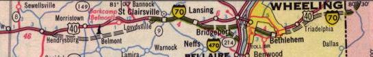
1964 Rand McNally showing
an incomplete I-70. Where the proposed I-70 meets US 40 west of Morristown
is where US 40 dies into I-70.
The four-lane
US 40 is immediately disrupted by the hillside that carries the Interstate.
This Terraserver
image shows I-70, US 40, the retaining pond that sometimes floods the
old alignment, and the old road ending into the embankment. Below,
a photo of the old and partially abandoned 4-lane US 40 ending at the hillside
that carries I-70.
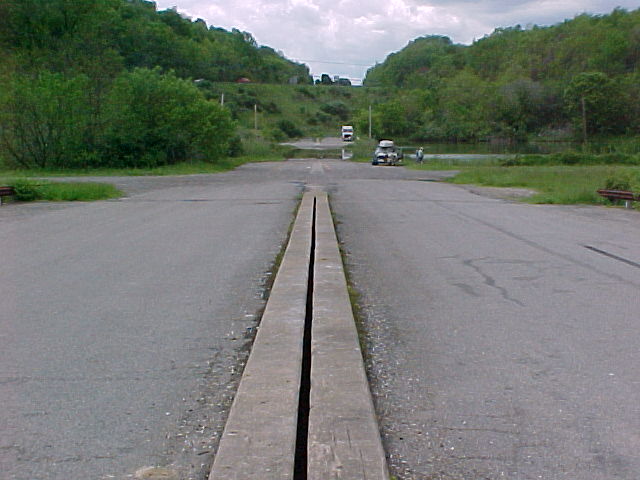
Old US 40 west of Morristown.
(Mike Austing)
Old US 40 Eastbound
(Belmont
County 102) at I-70.
(Mike Austing) |
The
Interstate was built directly on top of I-40 to just east of the OH 800/Hendrysburg
interchange. It is that point where the original US 40 can be found
on the south shoulder (see photo on left) of I-70 arching its way to OH
800 where route 800 meets I-70. This Terraserver
photo shows the old four lane US 40 just east of Hendrysburg.
The eastbound lanes still remain usable; however, the old westbound
highway has been reduced to gravel or
weeds and is used as a parking area for local residents and trailer
loads.
Old US 40 follows
OH 800 on a two lane bypass of Hendrysburg. The original National
Road runs through the town. Hendrysburg was founded in the 1820's
by Charles
Hendry, whose parents settled near the town in 1797. William
Boyd, better known as Hopalong
Cassidy was born in Hendrysburg in 1895. |
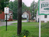
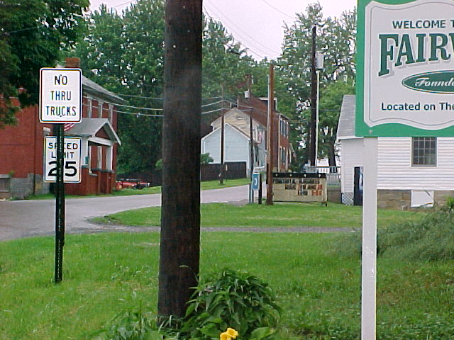
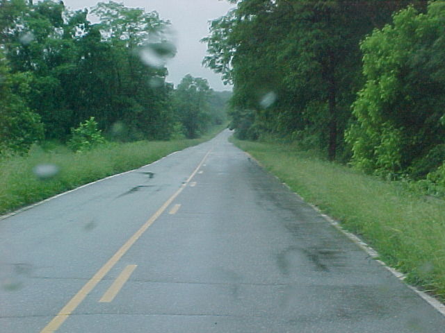
A Quiet National Road
through
Fairview. (Mike Austing) |
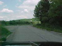
If you were
to exit of the Interstate at Exit 198, you are able to access the village
of Fairview.
Because of the heritage of the National Road, Fairview survives in spite
of the hustling super highway near by. The main thoroughfare through
Fairview is the original National Pike and what once was Route 40.
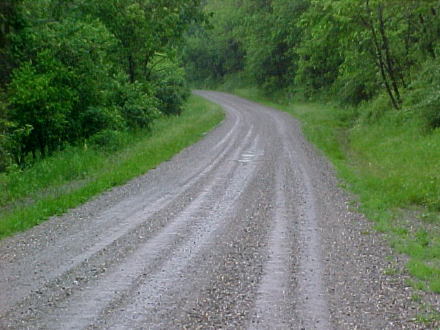
It is easy to
trace the National Road out of Fairview, east or west. Continuing
east, follow County Route 40-A. County Route 967 takes you out of
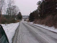
town to the west. County Road 967 varies from gravel to paved. |

County Road 967 a true
country
gravel back road.
(Mike Austing) |
The National
Road in Ohio is full of various road, historical, and Americana features.
From the famous 'Y' Bridge in Zanesville to the Zane
Grey Museum and through the numerous farming towns, some of the most
colorful stories along this road are found in Ohio. If you would
like to assist in this project, please e-mail me at canesfan27@yahoo.com.
Continuing on the Trail:
East over the
Wheeling Suspension Bridge
West through Old
Concord and to Cambridge
National
Pike Photo Essay Index
Site Navigation,
Sources & Links:
(1) Gibson, Denny. "The National Road
in Ohio." Personal E-Mail. (Sept. 12, 2004)
The
National Road @ roadfan.com ---Marc Fannin and Sandor Gulyas
US
40 @ Unofficial Ohio State Highways Web Site ---John Simpson
US 40 @ OHHighways.com ---Jeff Kitsko
Route
40 Net ---Frank Brusca
Brian
Polidoro
Sam Feldman
Mike Austing
Page Created: April 1, 2002
Last Updated: March 5, 2005
(C) 2002-05 William
Lawson
