1965 Aerial Construction Photos
By 1965, the city and the county had seen I-85 completed from the Catawba River at the Gaston County Line to what was once called the "Lower Connector," modern day exit 43. Lake Norman had just recently been carved out of the local landscape. The major north/south route through the county was US 21 known as Statesville Road in the north and South Blvd. in the south. Interstate 77 was authorized to enter the county along the same route we are familiar with today and end at I-85. Independent to the federal project were plans unveiled in 1960 for a 'North-South Expressway'. In 1965 construction for the two projects were well underway and by 1968 both freeways were scheduled to become part of I-77 which was legislatively extended to Columbia, SC. (1)
A large thank
you goes to Chris Curley who produced the scans from Aerial Photographs
of Mecklenburg County, N. C. from National Aerial Surveys, Photogrammetric
Engineering in Charlotte and provides most of the descriptions.
|
|
||
|
|
|
|
|
|
 |
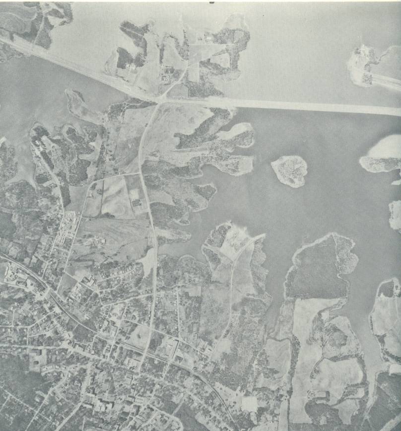
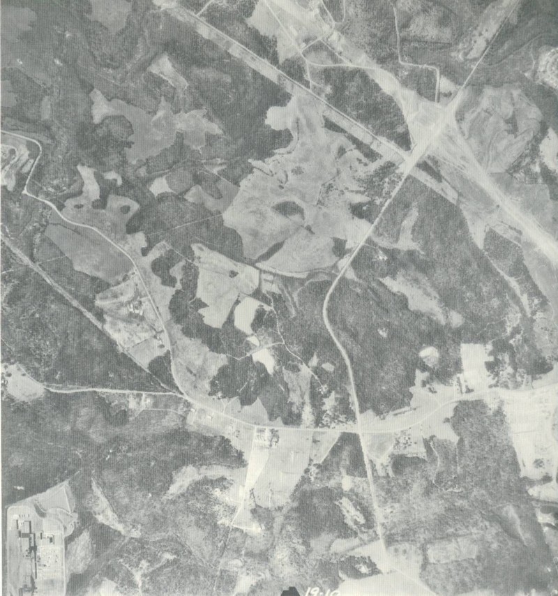
I-77 is being built from left to right near the Mecklenburg/Iredell County Line at the top of the photo. A few roads have been recently truncated as a result of the building of the man-made lake. At the bottom is US 21 which may have been routed with NC 115 at the time. |
 |
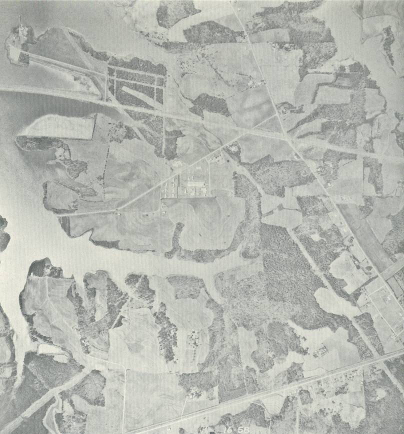
I-77 was in the process of being built in Northern Mecklenburg County in 1965. The causeways that carry I-77 over the lake are built; however, no pavement exists as it is only graded for what will carry four lanes of traffic in the future. The interchange that is shown is now Exit 30 Davidson. |
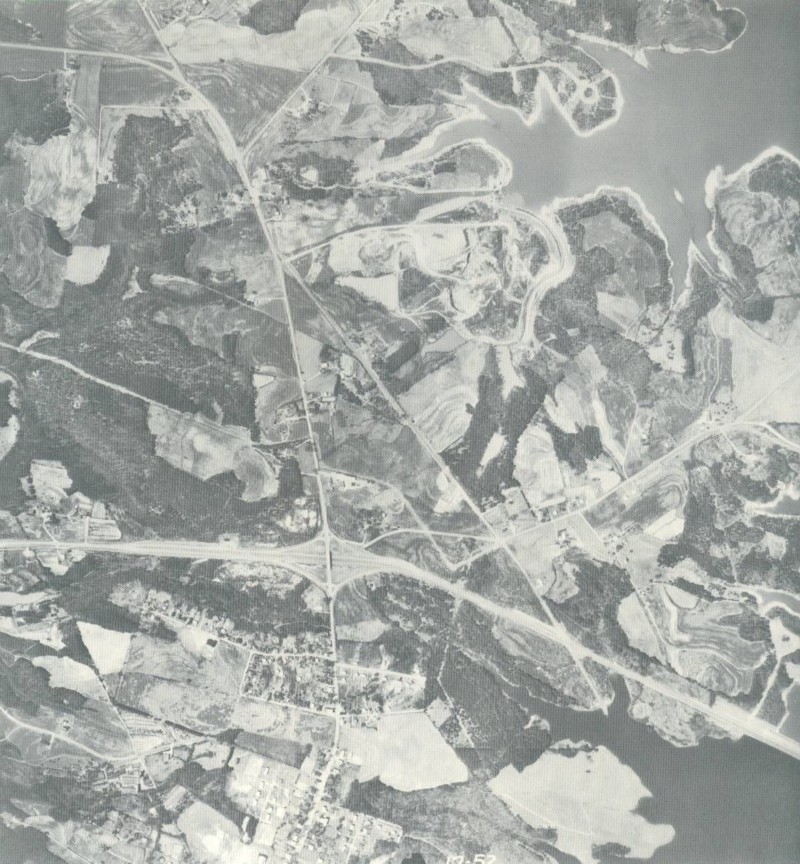 |
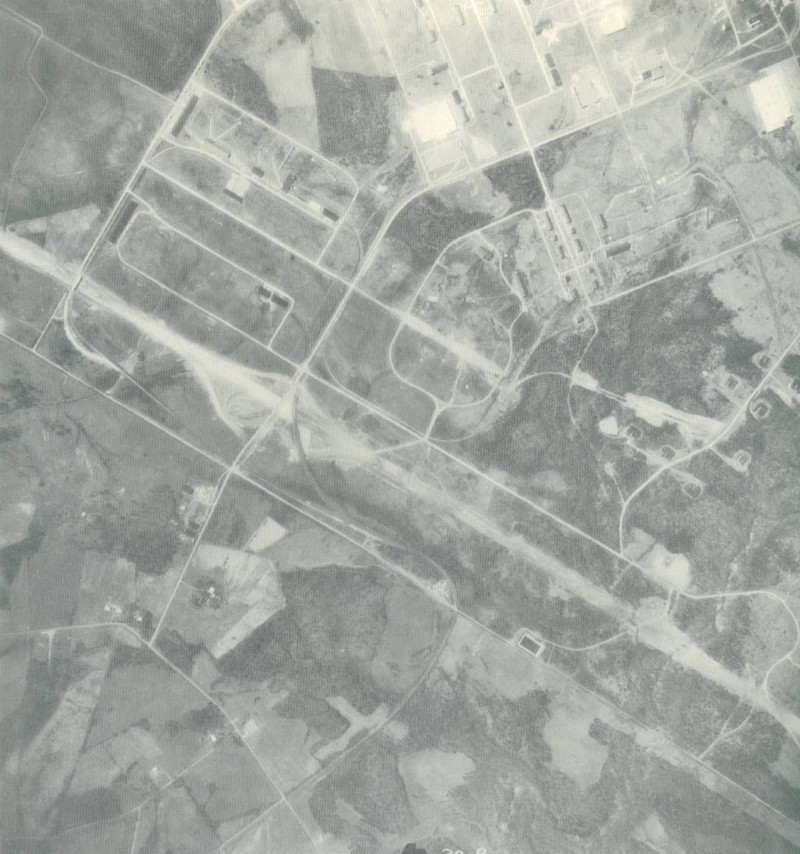
I-77 is being built at Exit 28 near Cornelius. After construction was completed, I-77 would dump four lanes of traffic onto a two lane US 21 just south of the interchange. The next fifteen miles, to Interstate 85, would not see construction start until the 1970s and completed by the middle of that decade. You can see clearly where I-77 transitions into US 21. |
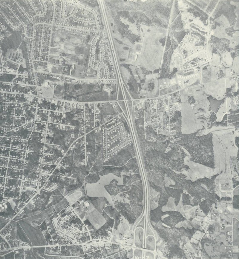 |
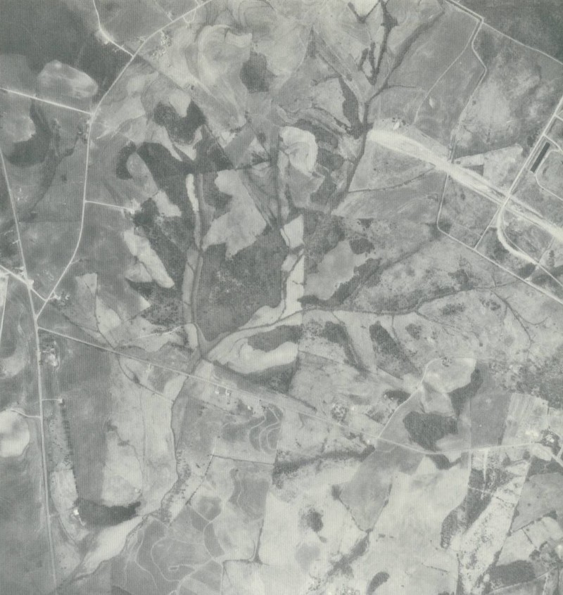
Notice something missing from this aerial? It's I-77. This image is of Interstate 85 at the location where I-77 now crosses. The Statesville Rd. (Exit 39) interchange is at the bottom of the picture and Beatties Ford Rd (Exit 37) is at the top. The school at the top is West Charlotte High. I-77 now runs through where the lake is in the middle of the picture. |
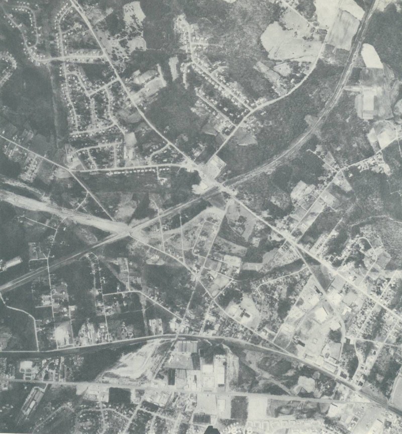 |
You can see the construction end at what will be the railroad overpass just south of Woodlawn (Exits 6A-B). The road that is cut in half at the railroad tracks is Nations Ford Rd. The section of road just above where the construction ends is now Nations Ford Rd. The section below the construction was also named Nations Ford Rd. until the 1990's when it was renamed Nations Crossing Rd. The roads running across the bottom are South Blvd. and Old Pineville Rd. The construction at the crossroads in bottom center (South Blvd & Woodlawn) is for a Zayre's Department Store. There is a Media Play at the site today. The road running along the railroad tracks to the left is Wilmount Rd. Billy Graham Pkwy now runs through the woods between Wilmount Rd and the railroad tracks. |
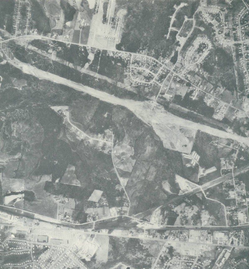 |
Construction at the Tyvola Road Interchange (Exit 5). You can see in the picture that there is no construction for Tyvola Rd. east of I-77 towards Old Pineville Rd. and South Blvd. which are running across the bottom. The interchange was completely overhauled from the original diamond interchange to a SPUI in the late 90s. |
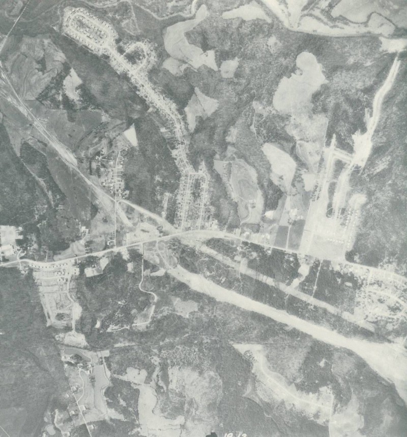 |
The Nations Ford Rd. Interchange (Exit 4) is towards the left. |
 |
Clearing has been made in the vicinity of Exit 3 (Arrowood Road). The crossroads at the bottom is the intersection of Nations Ford & Arrowood Roads. |
 |
Plenty of work still remains at what will be the Westinghouse Blvd. (Exit 1) Interchange. |
 |
Construction abruptly stops at the state line in the middle of the photo. Carowinds would be in the empty field above the construction. You can also see where the railroad overpass is being constructed at the lower right. US 21 (now NC-SC 51) is at the left. |
Page Created: September 28, 2004
Last Updated: September 29, 2004
(C) 2004 William Lawson
I-77 Shield Courtesy of Chris Jordan