Abandoned alignments
of GA 139 and 314 around Hartsfield-Jackson International Airport
 When
an airport expands, the growing facility usually takes a lot with it.
And in the case of the recent runway expansion of Atlanta's Hartsfield-Jackson
International Airport, many changes have been made to the highway system
surrounding it. The first changes occurred in the early to mid 1970's.
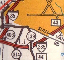
The expansion of the airport led to a rerouting of GA 139 and a change
to the terminus of GA 314. The 1978 GDOT map shows the results of
the 1970s expansion at right.
When
an airport expands, the growing facility usually takes a lot with it.
And in the case of the recent runway expansion of Atlanta's Hartsfield-Jackson
International Airport, many changes have been made to the highway system
surrounding it. The first changes occurred in the early to mid 1970's.
The expansion of the airport led to a rerouting of GA 139 and a change
to the terminus of GA 314. The 1978 GDOT map shows the results of
the 1970s expansion at right.
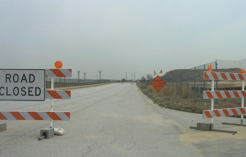
Nearly 30 years later, another runway
expansion would greatly alter the southern grounds of the airport.
Along with other surface streets, GA 139 and 314 were greatly impacted.
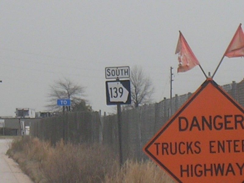
GA 139 now snakes its way through the airport grounds while GA 314 has
been scaled back to end at GA 139 just inside the Perimeter (I-285).
The changes to both routes and various surface streets have left interesting
pockets of former alignments of the two state highways within the airport's
grounds. John Krakoff takes a look at some of the surprises still
left standing.
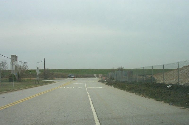
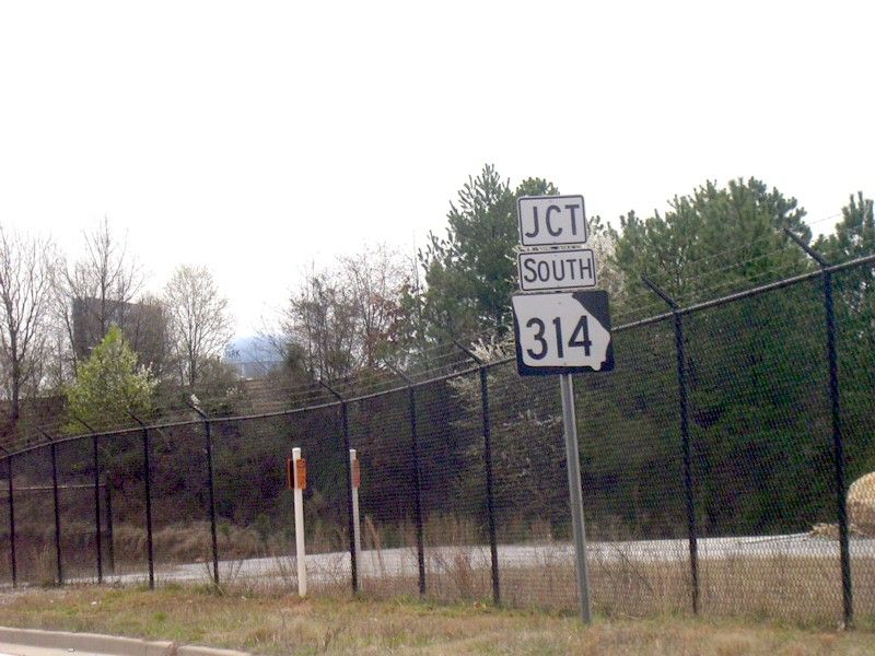
Former Northern Terminus
of GA 314:
Leftover signage:
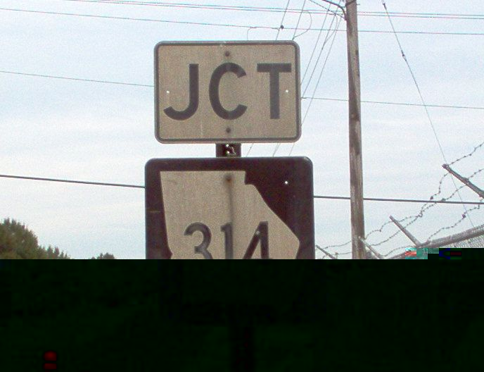
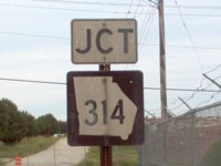 An
aging 'JCT' GA 314 shield found along a surface street. An
aging 'JCT' GA 314 shield found along a surface street. |
 An
archaic Stop Ahead warning sign in the same area. An
archaic Stop Ahead warning sign in the same area. |
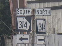 More
leftover GA 314 shields. More
leftover GA 314 shields. |
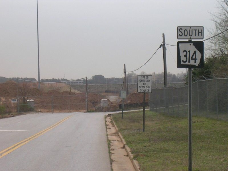
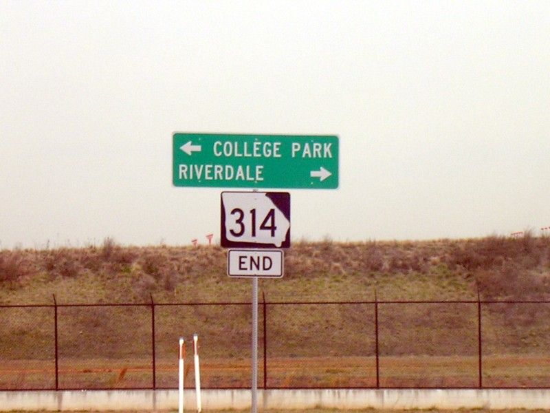
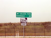
Current Northern GA
314 Terminus:
 |
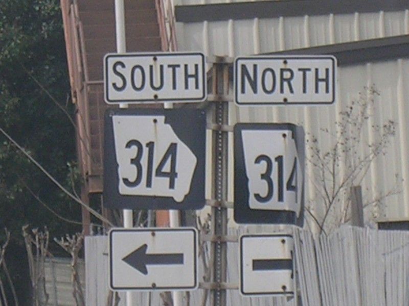
Left Photo: A 'JCT'
South GA 314 shield is found along GA 139 North.
Right Photo: The 'END'
GA 314 assembly marking the new northern terminus of GA 314. The
expanded airport runway is right behind the sign and fence. |
 |
Site Navigation:
Return
to the Metro Atlanta Index
Return
to the Georgia Road Photos Index
Sources & Links:
John Krakoff
GA
314 @ Peach State Roads ---Trent Legg
GA
314 @ State-ends.com ---Geoff Hatchard
Page Created: June 10, 2007
Last Updated: June 10, 2007
© 2007 William
Lawson